BLA Blacksburg, Virginia, USA - Earthquake Result Viewer
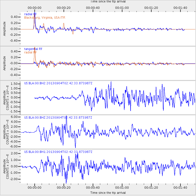
Earthquake location: Andreanof Islands, Aleutian Is.
Earthquake latitude/longitude: 51.6/-174.8
Earthquake time(UTC): 2013/09/04 (247) 02:32:30 GMT
Earthquake Depth: 20 km
Earthquake Magnitude: 6.5 MWW, 5.9 ML, 6.3 MWB, 6.5 MI, 6.5 MWC, 6.5 MWW
Earthquake Catalog/Contributor: NEIC PDE/NEIC COMCAT
Network: US United States National Seismic Network
Station: BLA Blacksburg, Virginia, USA
Lat/Lon: 37.21 N/80.42 W
Elevation: 634 m
Distance: 64.4 deg
Az: 62.004 deg
Baz: 316.333 deg
Ray Param: 0.05894801
Estimated Moho Depth: 60.0 km
Estimated Crust Vp/Vs: 2.10
Assumed Crust Vp: 6.159 km/s
Estimated Crust Vs: 2.936 km/s
Estimated Crust Poisson's Ratio: 0.35
Radial Match: 94.09552 %
Radial Bump: 400
Transverse Match: 77.14042 %
Transverse Bump: 400
SOD ConfigId: 626651
Insert Time: 2014-04-18 10:25:33.818 +0000
GWidth: 2.5
Max Bumps: 400
Tol: 0.001

Signal To Noise

ChannelStoNSTALTA
US:BLA:00:BHZ:20130904T02:42:33.873987Z10.0936831.5174463E-61.5033623E-7
US:BLA:00:BH1:20130904T02:42:33.873987Z4.0704675.2618117E-71.29268E-7
US:BLA:00:BH2:20130904T02:42:33.873987Z4.8161993.9136577E-78.126031E-8
Arrivals
Ps11 SECOND
PpPs29 SECOND
PsPs/PpSs40 SECOND