BW06 Boulder Array Site 6 (Pinedale), Wyoming, USA - Earthquake Result Viewer
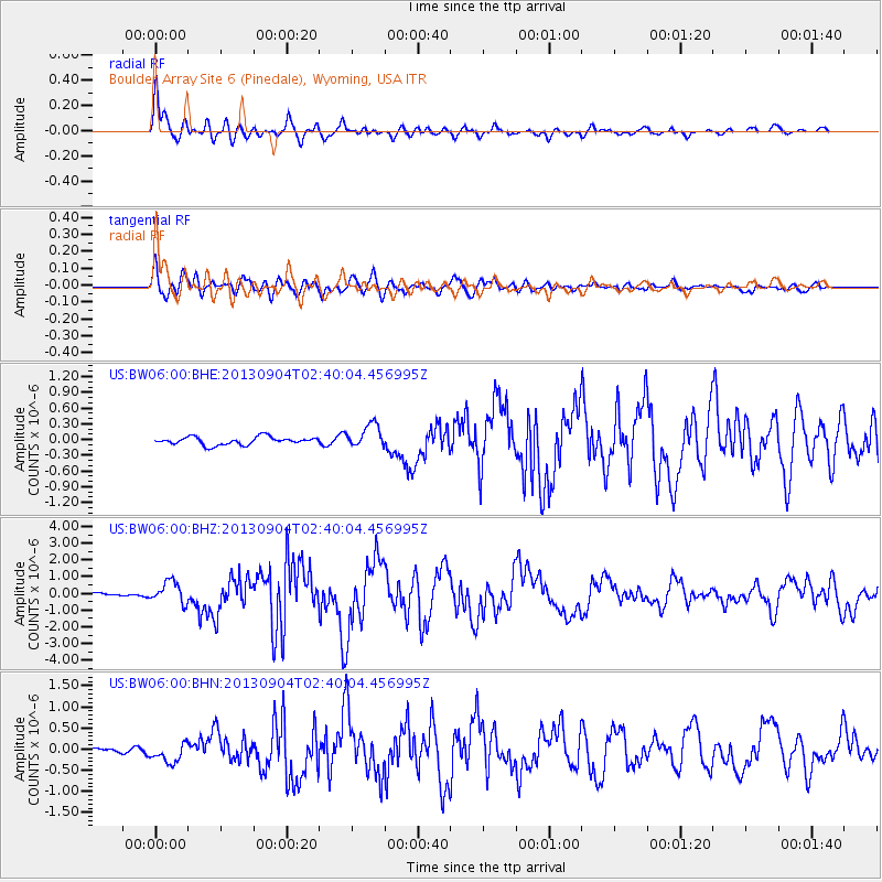
Earthquake location: Andreanof Islands, Aleutian Is.
Earthquake latitude/longitude: 51.6/-174.8
Earthquake time(UTC): 2013/09/04 (247) 02:32:30 GMT
Earthquake Depth: 20 km
Earthquake Magnitude: 6.5 MWW, 5.9 ML, 6.3 MWB, 6.5 MI, 6.5 MWC, 6.5 MWW
Earthquake Catalog/Contributor: NEIC PDE/NEIC COMCAT
Network: US United States National Seismic Network
Station: BW06 Boulder Array Site 6 (Pinedale), Wyoming, USA
Lat/Lon: 42.77 N/109.56 W
Elevation: 2224 m
Distance: 43.8 deg
Az: 74.839 deg
Baz: 305.089 deg
Ray Param: 0.07226385
Estimated Moho Depth: 50.5 km
Estimated Crust Vp/Vs: 1.65
Assumed Crust Vp: 6.161 km/s
Estimated Crust Vs: 3.728 km/s
Estimated Crust Poisson's Ratio: 0.21
Radial Match: 93.231544 %
Radial Bump: 400
Transverse Match: 86.263824 %
Transverse Bump: 400
SOD ConfigId: 626651
Insert Time: 2014-04-18 10:25:40.008 +0000
GWidth: 2.5
Max Bumps: 400
Tol: 0.001

Signal To Noise

ChannelStoNSTALTA
US:BW06:00:BHZ:20130904T02:40:04.456995Z6.08940556.5707866E-71.07905215E-7
US:BW06:00:BHN:20130904T02:40:04.456995Z3.17383652.279623E-77.1825475E-8
US:BW06:00:BHE:20130904T02:40:04.456995Z3.02068922.243791E-77.428076E-8
Arrivals
Ps5.7 SECOND
PpPs20 SECOND
PsPs/PpSs26 SECOND