MNTX Cornudas Mountains, Texas, USA - Earthquake Result Viewer
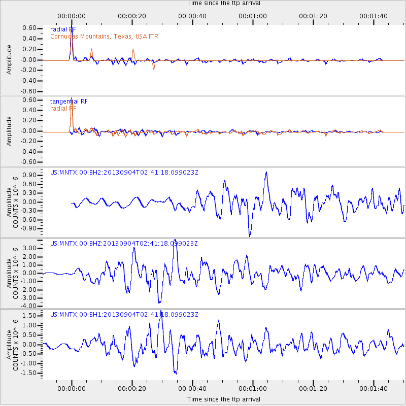
Earthquake location: Andreanof Islands, Aleutian Is.
Earthquake latitude/longitude: 51.6/-174.8
Earthquake time(UTC): 2013/09/04 (247) 02:32:30 GMT
Earthquake Depth: 20 km
Earthquake Magnitude: 6.5 MWW, 5.9 ML, 6.3 MWB, 6.5 MI, 6.5 MWC, 6.5 MWW
Earthquake Catalog/Contributor: NEIC PDE/NEIC COMCAT
Network: US United States National Seismic Network
Station: MNTX Cornudas Mountains, Texas, USA
Lat/Lon: 31.70 N/105.38 W
Elevation: 404 m
Distance: 53.4 deg
Az: 83.423 deg
Baz: 313.316 deg
Ray Param: 0.06608205
Estimated Moho Depth: 42.5 km
Estimated Crust Vp/Vs: 1.64
Assumed Crust Vp: 6.361 km/s
Estimated Crust Vs: 3.873 km/s
Estimated Crust Poisson's Ratio: 0.21
Radial Match: 94.92849 %
Radial Bump: 308
Transverse Match: 86.6423 %
Transverse Bump: 400
SOD ConfigId: 626651
Insert Time: 2014-04-18 10:26:47.995 +0000
GWidth: 2.5
Max Bumps: 400
Tol: 0.001

Signal To Noise

ChannelStoNSTALTA
US:MNTX:00:BHZ:20130904T02:41:18.099023Z4.22220754.2524374E-71.0071597E-7
US:MNTX:00:BH1:20130904T02:41:18.099023Z2.0127922.116527E-71.0515379E-7
US:MNTX:00:BH2:20130904T02:41:18.099023Z1.21859241.2367111E-71.0148686E-7
Arrivals
Ps4.5 SECOND
PpPs17 SECOND
PsPs/PpSs21 SECOND