MVCO Mesa Verde, Colorado, USA - Earthquake Result Viewer
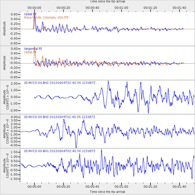
Earthquake location: Andreanof Islands, Aleutian Is.
Earthquake latitude/longitude: 51.6/-174.8
Earthquake time(UTC): 2013/09/04 (247) 02:32:30 GMT
Earthquake Depth: 20 km
Earthquake Magnitude: 6.5 MWW, 5.9 ML, 6.3 MWB, 6.5 MI, 6.5 MWC, 6.5 MWW
Earthquake Catalog/Contributor: NEIC PDE/NEIC COMCAT
Network: US United States National Seismic Network
Station: MVCO Mesa Verde, Colorado, USA
Lat/Lon: 37.21 N/108.50 W
Elevation: 2170 m
Distance: 47.9 deg
Az: 80.3 deg
Baz: 309.576 deg
Ray Param: 0.069700755
Estimated Moho Depth: 34.0 km
Estimated Crust Vp/Vs: 2.05
Assumed Crust Vp: 6.476 km/s
Estimated Crust Vs: 3.155 km/s
Estimated Crust Poisson's Ratio: 0.34
Radial Match: 92.045296 %
Radial Bump: 400
Transverse Match: 84.26981 %
Transverse Bump: 400
SOD ConfigId: 626651
Insert Time: 2014-04-18 10:26:52.355 +0000
GWidth: 2.5
Max Bumps: 400
Tol: 0.001

Signal To Noise

ChannelStoNSTALTA
US:MVCO:00:BHZ:20130904T02:40:36.123987Z4.0696285.4472275E-71.3385075E-7
US:MVCO:00:BH1:20130904T02:40:36.123987Z0.52907986.764897E-81.2786155E-7
US:MVCO:00:BH2:20130904T02:40:36.123987Z1.814652.554645E-71.4077894E-7
Arrivals
Ps5.8 SECOND
PpPs15 SECOND
PsPs/PpSs21 SECOND