OGNE Ogallala, Nebraska, USA - Earthquake Result Viewer
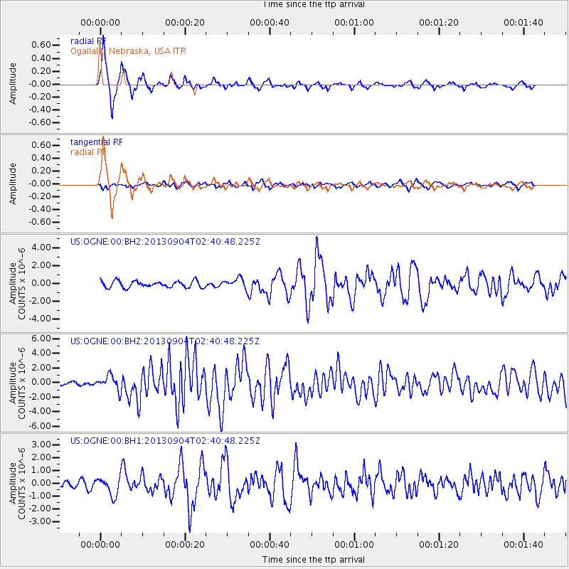
Earthquake location: Andreanof Islands, Aleutian Is.
Earthquake latitude/longitude: 51.6/-174.8
Earthquake time(UTC): 2013/09/04 (247) 02:32:30 GMT
Earthquake Depth: 20 km
Earthquake Magnitude: 6.5 MWW, 5.9 ML, 6.3 MWB, 6.5 MI, 6.5 MWC, 6.5 MWW
Earthquake Catalog/Contributor: NEIC PDE/NEIC COMCAT
Network: US United States National Seismic Network
Station: OGNE Ogallala, Nebraska, USA
Lat/Lon: 40.95 N/102.03 W
Elevation: 0.0 m
Distance: 49.4 deg
Az: 72.224 deg
Baz: 308.299 deg
Ray Param: 0.0686788
Estimated Moho Depth: 16.25 km
Estimated Crust Vp/Vs: 1.60
Assumed Crust Vp: 6.483 km/s
Estimated Crust Vs: 4.052 km/s
Estimated Crust Poisson's Ratio: 0.18
Radial Match: 94.13106 %
Radial Bump: 341
Transverse Match: 57.615463 %
Transverse Bump: 400
SOD ConfigId: 626651
Insert Time: 2014-04-18 10:27:03.930 +0000
GWidth: 2.5
Max Bumps: 400
Tol: 0.001

Signal To Noise

ChannelStoNSTALTA
US:OGNE:00:BHZ:20130904T02:40:48.225Z6.2213491.0530395E-61.6926224E-7
US:OGNE:00:BH1:20130904T02:40:48.225Z2.85076527.285053E-72.5554726E-7
US:OGNE:00:BH2:20130904T02:40:48.225Z1.64304945.937458E-73.6136822E-7
Arrivals
Ps1.6 SECOND
PpPs6.1 SECOND
PsPs/PpSs7.7 SECOND