SDCO Great Sand Dunes National Park, Colorado, USA - Earthquake Result Viewer
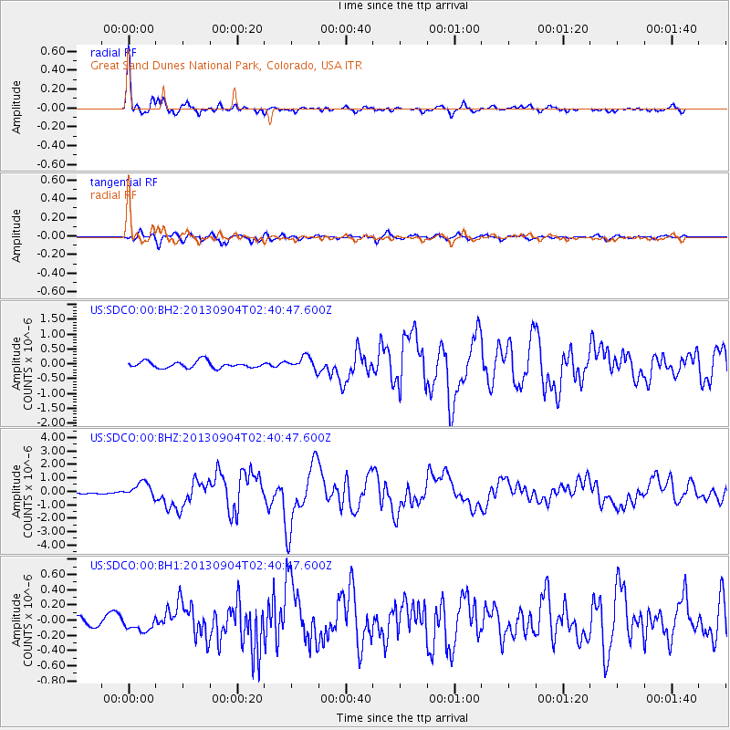
Earthquake location: Andreanof Islands, Aleutian Is.
Earthquake latitude/longitude: 51.6/-174.8
Earthquake time(UTC): 2013/09/04 (247) 02:32:30 GMT
Earthquake Depth: 20 km
Earthquake Magnitude: 6.5 MWW, 5.9 ML, 6.3 MWB, 6.5 MI, 6.5 MWC, 6.5 MWW
Earthquake Catalog/Contributor: NEIC PDE/NEIC COMCAT
Network: US United States National Seismic Network
Station: SDCO Great Sand Dunes National Park, Colorado, USA
Lat/Lon: 37.75 N/105.50 W
Elevation: 2569 m
Distance: 49.4 deg
Az: 77.724 deg
Baz: 309.689 deg
Ray Param: 0.068730004
Estimated Moho Depth: 49.75 km
Estimated Crust Vp/Vs: 1.65
Assumed Crust Vp: 6.316 km/s
Estimated Crust Vs: 3.816 km/s
Estimated Crust Poisson's Ratio: 0.21
Radial Match: 96.521545 %
Radial Bump: 396
Transverse Match: 87.07834 %
Transverse Bump: 400
SOD ConfigId: 626651
Insert Time: 2014-04-18 10:27:14.821 +0000
GWidth: 2.5
Max Bumps: 400
Tol: 0.001

Signal To Noise

ChannelStoNSTALTA
US:SDCO:00:BHZ:20130904T02:40:47.600Z4.66423375.5170204E-71.1828354E-7
US:SDCO:00:BH1:20130904T02:40:47.600Z1.25813579.366071E-87.4444046E-8
US:SDCO:00:BH2:20130904T02:40:47.600Z1.94158452.1802435E-71.1229197E-7
Arrivals
Ps5.5 SECOND
PpPs20 SECOND
PsPs/PpSs25 SECOND