WMOK Wichita Mountains, Oklahoma, USA - Earthquake Result Viewer
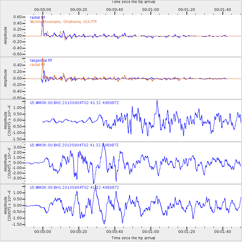
Earthquake location: Andreanof Islands, Aleutian Is.
Earthquake latitude/longitude: 51.6/-174.8
Earthquake time(UTC): 2013/09/04 (247) 02:32:30 GMT
Earthquake Depth: 20 km
Earthquake Magnitude: 6.5 MWW, 5.9 ML, 6.3 MWB, 6.5 MI, 6.5 MWC, 6.5 MWW
Earthquake Catalog/Contributor: NEIC PDE/NEIC COMCAT
Network: US United States National Seismic Network
Station: WMOK Wichita Mountains, Oklahoma, USA
Lat/Lon: 34.74 N/98.78 W
Elevation: 486 m
Distance: 55.4 deg
Az: 76.06 deg
Baz: 312.632 deg
Ray Param: 0.064784124
Estimated Moho Depth: 38.75 km
Estimated Crust Vp/Vs: 2.00
Assumed Crust Vp: 6.315 km/s
Estimated Crust Vs: 3.162 km/s
Estimated Crust Poisson's Ratio: 0.33
Radial Match: 96.065445 %
Radial Bump: 365
Transverse Match: 90.09547 %
Transverse Bump: 400
SOD ConfigId: 626651
Insert Time: 2014-04-18 10:27:23.727 +0000
GWidth: 2.5
Max Bumps: 400
Tol: 0.001

Signal To Noise

ChannelStoNSTALTA
US:WMOK:00:BHZ:20130904T02:41:32.498987Z5.3369286.409011E-71.2008802E-7
US:WMOK:00:BH1:20130904T02:41:32.498987Z3.83123762.739811E-77.1512424E-8
US:WMOK:00:BH2:20130904T02:41:32.498987Z3.62053662.8210638E-77.7918386E-8
Arrivals
Ps6.4 SECOND
PpPs18 SECOND
PsPs/PpSs24 SECOND