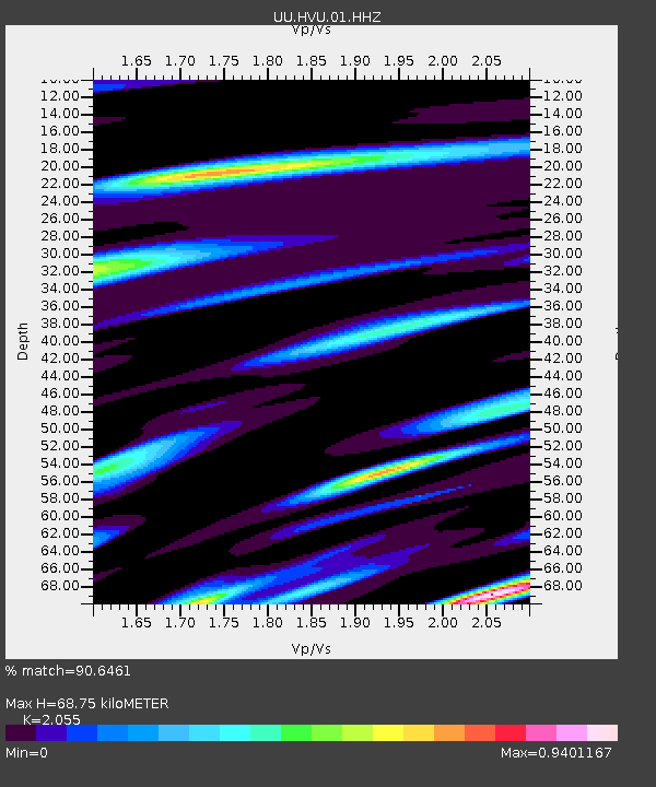
HVU Hansel Valley, UT, USA - Earthquake Result Viewer
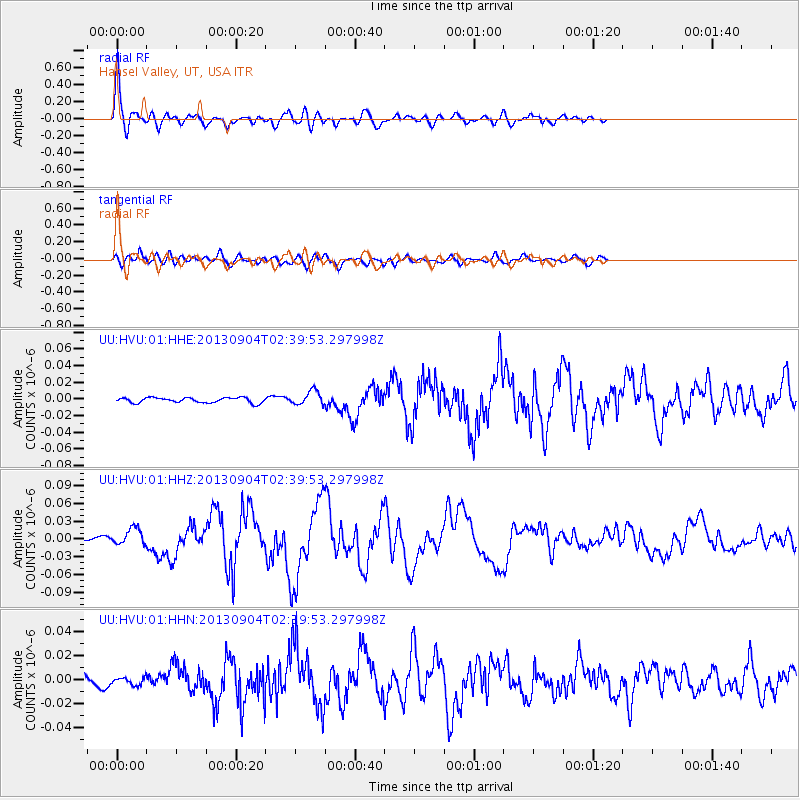
Earthquake location: Andreanof Islands, Aleutian Is.
Earthquake latitude/longitude: 51.6/-174.8
Earthquake time(UTC): 2013/09/04 (247) 02:32:30 GMT
Earthquake Depth: 20 km
Earthquake Magnitude: 6.5 MWW, 5.9 ML, 6.3 MWB, 6.5 MI, 6.5 MWC, 6.5 MWW
Earthquake Catalog/Contributor: NEIC PDE/NEIC COMCAT
Network: UU University of Utah Regional Network
Station: HVU Hansel Valley, UT, USA
Lat/Lon: 41.78 N/112.78 W
Elevation: 1609 m
Distance: 42.5 deg
Az: 78.028 deg
Baz: 305.26 deg
Ray Param: 0.07314032
Estimated Moho Depth: 68.75 km
Estimated Crust Vp/Vs: 2.06
Assumed Crust Vp: 6.276 km/s
Estimated Crust Vs: 3.054 km/s
Estimated Crust Poisson's Ratio: 0.34
Radial Match: 90.6461 %
Radial Bump: 400
Transverse Match: 78.06327 %
Transverse Bump: 400
SOD ConfigId: 626651
Insert Time: 2014-04-18 10:27:43.288 +0000
GWidth: 2.5
Max Bumps: 400
Tol: 0.001

Signal To Noise

ChannelStoNSTALTA
UU:HVU:01:HHZ:20130904T02:39:53.297998Z5.82051661.4261427E-82.4501994E-9
UU:HVU:01:HHN:20130904T02:39:53.297998Z0.92058133.1802652E-93.454627E-9
UU:HVU:01:HHE:20130904T02:39:53.297998Z2.69506458.333342E-93.0920755E-9
Arrivals
Ps12 SECOND
PpPs32 SECOND
PsPs/PpSs44 SECOND