HOOD Mt Hood Meadows, OR CREST BB SMO - Earthquake Result Viewer
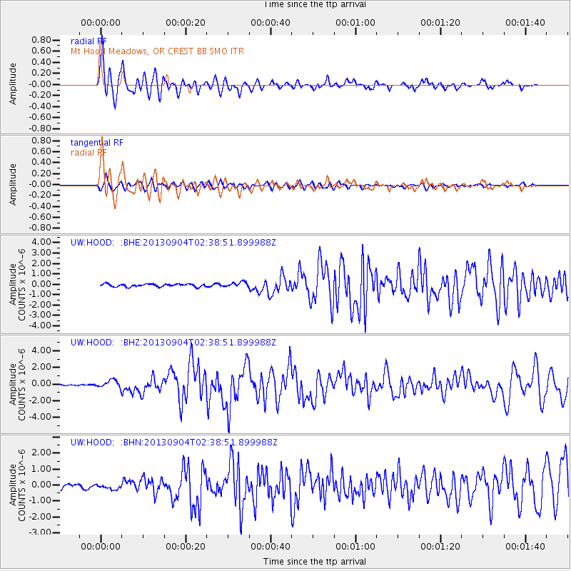
Earthquake location: Andreanof Islands, Aleutian Is.
Earthquake latitude/longitude: 51.6/-174.8
Earthquake time(UTC): 2013/09/04 (247) 02:32:30 GMT
Earthquake Depth: 20 km
Earthquake Magnitude: 6.5 MWW, 5.9 ML, 6.3 MWB, 6.5 MI, 6.5 MWC, 6.5 MWW
Earthquake Catalog/Contributor: NEIC PDE/NEIC COMCAT
Network: UW Pacific Northwest Regional Seismic Network
Station: HOOD Mt Hood Meadows, OR CREST BB SMO
Lat/Lon: 45.32 N/121.65 W
Elevation: 1520 m
Distance: 35.1 deg
Az: 78.811 deg
Baz: 299.766 deg
Ray Param: 0.07736802
Estimated Moho Depth: 29.75 km
Estimated Crust Vp/Vs: 2.10
Assumed Crust Vp: 6.597 km/s
Estimated Crust Vs: 3.145 km/s
Estimated Crust Poisson's Ratio: 0.35
Radial Match: 88.61258 %
Radial Bump: 400
Transverse Match: 71.28356 %
Transverse Bump: 400
SOD ConfigId: 626651
Insert Time: 2014-04-18 10:28:38.934 +0000
GWidth: 2.5
Max Bumps: 400
Tol: 0.001

Signal To Noise

ChannelStoNSTALTA
UW:HOOD: :BHZ:20130904T02:38:51.899988Z5.7672894.7755947E-78.280484E-8
UW:HOOD: :BHN:20130904T02:38:51.899988Z0.858918851.4724466E-71.7143024E-7
UW:HOOD: :BHE:20130904T02:38:51.899988Z1.78591482.3158958E-71.296756E-7
Arrivals
Ps5.3 SECOND
PpPs13 SECOND
PsPs/PpSs18 SECOND