WOLL Wollman Farm, Schrag, WA, USA - Earthquake Result Viewer
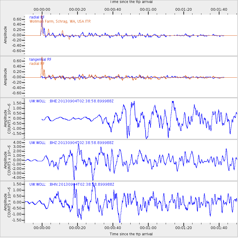
Earthquake location: Andreanof Islands, Aleutian Is.
Earthquake latitude/longitude: 51.6/-174.8
Earthquake time(UTC): 2013/09/04 (247) 02:32:30 GMT
Earthquake Depth: 20 km
Earthquake Magnitude: 6.5 MWW, 5.9 ML, 6.3 MWB, 6.5 MI, 6.5 MWC, 6.5 MWW
Earthquake Catalog/Contributor: NEIC PDE/NEIC COMCAT
Network: UW Pacific Northwest Regional Seismic Network
Station: WOLL Wollman Farm, Schrag, WA, USA
Lat/Lon: 47.06 N/118.92 W
Elevation: 385 m
Distance: 35.9 deg
Az: 74.612 deg
Baz: 298.315 deg
Ray Param: 0.07693138
Estimated Moho Depth: 16.5 km
Estimated Crust Vp/Vs: 1.60
Assumed Crust Vp: 6.419 km/s
Estimated Crust Vs: 4.012 km/s
Estimated Crust Poisson's Ratio: 0.18
Radial Match: 93.02297 %
Radial Bump: 342
Transverse Match: 79.41747 %
Transverse Bump: 400
SOD ConfigId: 626651
Insert Time: 2014-04-18 10:29:10.136 +0000
GWidth: 2.5
Max Bumps: 400
Tol: 0.001

Signal To Noise

ChannelStoNSTALTA
UW:WOLL: :BHZ:20130904T02:38:58.899988Z4.3516146.401654E-71.4710987E-7
UW:WOLL: :BHN:20130904T02:38:58.899988Z2.39058162.894835E-71.2109334E-7
UW:WOLL: :BHE:20130904T02:38:58.899988Z2.19217562.388473E-71.0895445E-7
Arrivals
Ps1.7 SECOND
PpPs6.1 SECOND
PsPs/PpSs7.8 SECOND