YACT Amboy, WA, USA - Earthquake Result Viewer
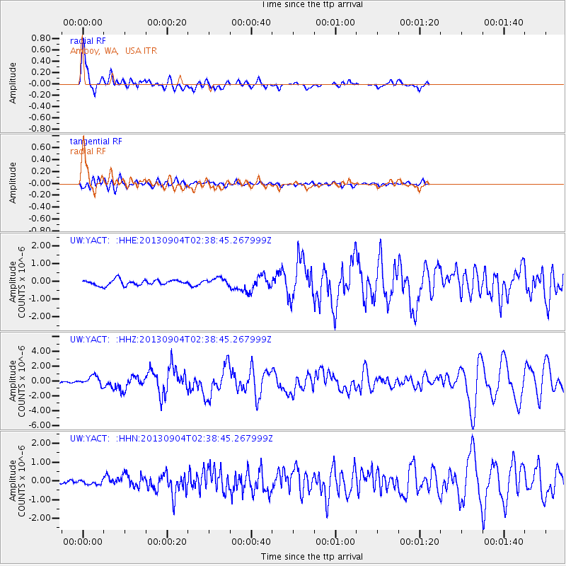
Earthquake location: Andreanof Islands, Aleutian Is.
Earthquake latitude/longitude: 51.6/-174.8
Earthquake time(UTC): 2013/09/04 (247) 02:32:30 GMT
Earthquake Depth: 20 km
Earthquake Magnitude: 6.5 MWW, 5.9 ML, 6.3 MWB, 6.5 MI, 6.5 MWC, 6.5 MWW
Earthquake Catalog/Contributor: NEIC PDE/NEIC COMCAT
Network: UW Pacific Northwest Regional Seismic Network
Station: YACT Amboy, WA, USA
Lat/Lon: 45.93 N/122.42 W
Elevation: 211 m
Distance: 34.3 deg
Az: 78.337 deg
Baz: 298.831 deg
Ray Param: 0.07776485
Estimated Moho Depth: 40.75 km
Estimated Crust Vp/Vs: 2.03
Assumed Crust Vp: 6.566 km/s
Estimated Crust Vs: 3.235 km/s
Estimated Crust Poisson's Ratio: 0.34
Radial Match: 88.92662 %
Radial Bump: 400
Transverse Match: 78.41864 %
Transverse Bump: 400
SOD ConfigId: 626651
Insert Time: 2014-04-18 10:29:14.648 +0000
GWidth: 2.5
Max Bumps: 400
Tol: 0.001

Signal To Noise

ChannelStoNSTALTA
UW:YACT: :HHZ:20130904T02:38:45.267999Z5.684646.3970083E-71.1253145E-7
UW:YACT: :HHN:20130904T02:38:45.267999Z0.899568741.1404303E-71.2677523E-7
UW:YACT: :HHE:20130904T02:38:45.267999Z1.33332052.0814613E-71.561111E-7
Arrivals
Ps6.9 SECOND
PpPs18 SECOND
PsPs/PpSs24 SECOND