You are here: Home > Network List > IU - Global Seismograph Network (GSN - IRIS/USGS) Stations List
> Station HNR Honiara, Solomon Islands > Earthquake Result Viewer
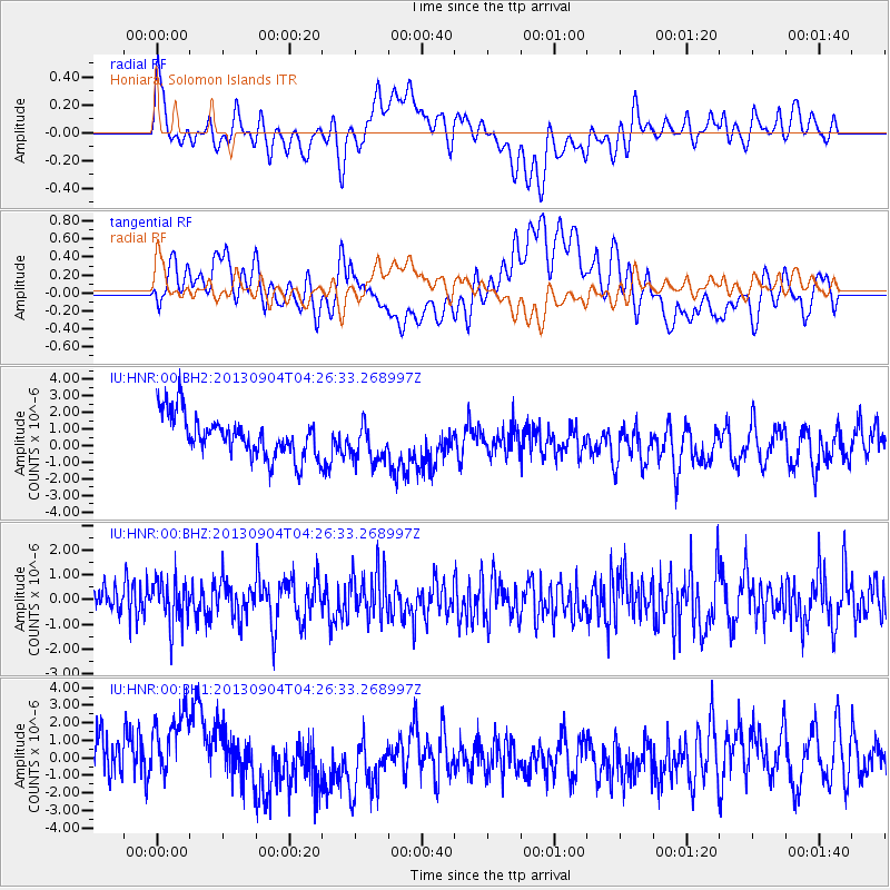
HNR Honiara, Solomon Islands - Earthquake Result Viewer
*The percent match for this event was below the threshold and hence no stack was calculated.
| Earthquake location: |
Andreanof Islands, Aleutian Is. |
| Earthquake latitude/longitude: |
51.4/-174.7 |
| Earthquake time(UTC): |
2013/09/04 (247) 04:16:30 GMT |
| Earthquake Depth: |
27 km |
| Earthquake Magnitude: |
5.9 MW, 5.2 ML, 5.4 ML, 5.8 MWW, 5.8 MWW, 5.9 MWC |
| Earthquake Catalog/Contributor: |
NEIC PDE/NEIC COMCAT |
|
| Network: |
IU Global Seismograph Network (GSN - IRIS/USGS) |
| Station: |
HNR Honiara, Solomon Islands |
| Lat/Lon: |
9.44 S/159.95 E |
| Elevation: |
100 m |
|
| Distance: |
64.5 deg |
| Az: |
207.896 deg |
| Baz: |
17.262 deg |
| Ray Param: |
$rayparam |
*The percent match for this event was below the threshold and hence was not used in the summary stack. |
|
| Radial Match: |
56.73912 % |
| Radial Bump: |
400 |
| Transverse Match: |
52.999973 % |
| Transverse Bump: |
400 |
| SOD ConfigId: |
626651 |
| Insert Time: |
2014-04-18 10:38:55.258 +0000 |
| GWidth: |
2.5 |
| Max Bumps: |
400 |
| Tol: |
0.001 |
|
Signal To Noise
| Channel | StoN | STA | LTA |
| IU:HNR:00:BHZ:20130904T04:26:33.268997Z | 1.2971869 | 8.970679E-7 | 6.915487E-7 |
| IU:HNR:00:BH1:20130904T04:26:33.268997Z | 1.6520404 | 2.2448064E-6 | 1.3588084E-6 |
| IU:HNR:00:BH2:20130904T04:26:33.268997Z | 0.9449089 | 1.1863893E-6 | 1.2555595E-6 |
| Arrivals |
| Ps | |
| PpPs | |
| PsPs/PpSs | |


