You are here: Home > Network List > IU - Global Seismograph Network (GSN - IRIS/USGS) Stations List
> Station PMG Port Moresby, New Guinea > Earthquake Result Viewer
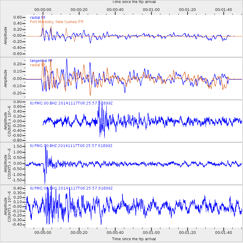
PMG Port Moresby, New Guinea - Earthquake Result Viewer
*The percent match for this event was below the threshold and hence no stack was calculated.
| Earthquake location: |
Fiji Islands Region |
| Earthquake latitude/longitude: |
-21.6/-179.2 |
| Earthquake time(UTC): |
2014/11/17 (321) 06:20:29 GMT |
| Earthquake Depth: |
614 km |
| Earthquake Magnitude: |
5.5 MW, 4.8 mb |
| Earthquake Catalog/Contributor: |
ISC/ISC |
|
| Network: |
IU Global Seismograph Network (GSN - IRIS/USGS) |
| Station: |
PMG Port Moresby, New Guinea |
| Lat/Lon: |
9.40 S/147.16 E |
| Elevation: |
90 m |
|
| Distance: |
34.5 deg |
| Az: |
285.258 deg |
| Baz: |
114.482 deg |
| Ray Param: |
$rayparam |
*The percent match for this event was below the threshold and hence was not used in the summary stack. |
|
| Radial Match: |
56.58541 % |
| Radial Bump: |
400 |
| Transverse Match: |
60.72732 % |
| Transverse Bump: |
400 |
| SOD ConfigId: |
3390531 |
| Insert Time: |
2019-04-15 01:28:05.397 +0000 |
| GWidth: |
2.5 |
| Max Bumps: |
400 |
| Tol: |
0.001 |
|
Signal To Noise
| Channel | StoN | STA | LTA |
| IU:PMG:00:BHZ:20141117T06:25:57.61899Z | 7.451207 | 6.4289617E-7 | 8.628081E-8 |
| IU:PMG:00:BH1:20141117T06:25:57.61899Z | 2.096909 | 2.0346849E-7 | 9.7032576E-8 |
| IU:PMG:00:BH2:20141117T06:25:57.61899Z | 3.3597221 | 3.4962503E-7 | 1.04063666E-7 |
| Arrivals |
| Ps | |
| PpPs | |
| PsPs/PpSs | |


