CGRP Cima Grappa - Earthquake Result Viewer

*The percent match for this event was below the threshold and hence no stack was calculated.
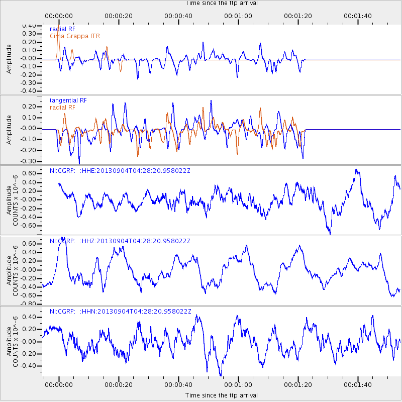
Earthquake location: Andreanof Islands, Aleutian Is.
Earthquake latitude/longitude: 51.4/-174.7
Earthquake time(UTC): 2013/09/04 (247) 04:16:30 GMT
Earthquake Depth: 27 km
Earthquake Magnitude: 5.9 MW, 5.2 ML, 5.4 ML, 5.8 MWW, 5.8 MWW, 5.9 MWC
Earthquake Catalog/Contributor: NEIC PDE/NEIC COMCAT
Network: NI North-East Italy Broadband Network
Station: CGRP Cima Grappa
Lat/Lon: 45.88 N/11.80 E
Elevation: 1757 m

*The percent match for this event was below the threshold and hence was not used in the summary stack.

Distance: 82.9 deg
Az: 355.414 deg
Baz: 4.107 deg
Ray Param: $rayparam
Radial Match: 59.70735 %
Radial Bump: 400
Transverse Match: 49.38352 %
Transverse Bump: 400
SOD ConfigId: 626651
Insert Time: 2014-04-18 10:41:50.234 +0000
GWidth: 2.5
Max Bumps: 400
Tol: 0.001

Signal To Noise

ChannelStoNSTALTA
NI:CGRP: :HHZ:20130904T04:28:20.958022Z2.99585064.8142766E-71.6069815E-7
NI:CGRP: :HHN:20130904T04:28:20.958022Z0.98513171.4938747E-71.5164214E-7
NI:CGRP: :HHE:20130904T04:28:20.958022Z0.663941561.083444E-71.6318364E-7
Arrivals
Ps
PpPs
PsPs/PpSs