You are here: Home > Network List > CI - Caltech Regional Seismic Network Stations List
> Station TIN Tinemaha, California, USA > Earthquake Result Viewer
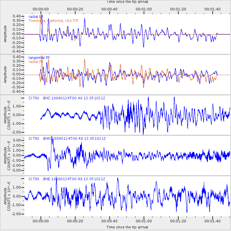
TIN Tinemaha, California, USA - Earthquake Result Viewer
*The percent match for this event was below the threshold and hence no stack was calculated.
| Earthquake location: |
Kyushu, Japan |
| Earthquake latitude/longitude: |
30.6/131.1 |
| Earthquake time(UTC): |
1999/01/24 (024) 00:37:04 GMT |
| Earthquake Depth: |
33 km |
| Earthquake Magnitude: |
6.1 MB, 6.1 MS, 6.4 MW, 6.4 MW |
| Earthquake Catalog/Contributor: |
WHDF/NEIC |
|
| Network: |
CI Caltech Regional Seismic Network |
| Station: |
TIN Tinemaha, California, USA |
| Lat/Lon: |
37.05 N/118.23 W |
| Elevation: |
1164 m |
|
| Distance: |
86.5 deg |
| Az: |
48.574 deg |
| Baz: |
306.1 deg |
| Ray Param: |
$rayparam |
*The percent match for this event was below the threshold and hence was not used in the summary stack. |
|
| Radial Match: |
75.197296 % |
| Radial Bump: |
400 |
| Transverse Match: |
69.81184 % |
| Transverse Bump: |
400 |
| SOD ConfigId: |
4480 |
| Insert Time: |
2010-02-25 20:51:44.841 +0000 |
| GWidth: |
2.5 |
| Max Bumps: |
400 |
| Tol: |
0.001 |
|
Signal To Noise
| Channel | StoN | STA | LTA |
| CI:TIN: :BHN:19990124T00:49:13.051021Z | 4.9120693 | 8.842584E-7 | 1.8001748E-7 |
| CI:TIN: :BHE:19990124T00:49:13.051021Z | 0.83062947 | 2.594379E-7 | 3.1233893E-7 |
| CI:TIN: :BHZ:19990124T00:49:13.051021Z | 1.0342909 | 2.54913E-7 | 2.464616E-7 |
| Arrivals |
| Ps | |
| PpPs | |
| PsPs/PpSs | |


