
F49A Sandfield, ON, CAN - Earthquake Result Viewer
| ||||||||||||||||||
| ||||||||||||||||||
| ||||||||||||||||||
|
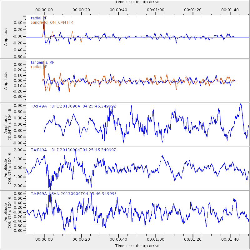
Signal To Noise
| Channel | StoN | STA | LTA |
| TA:F49A: :BHZ:20130904T04:25:46.34999Z | 1.9132637 | 1.2388175E-6 | 6.474892E-7 |
| TA:F49A: :BHN:20130904T04:25:46.34999Z | 1.2435207 | 3.8819866E-7 | 3.1217706E-7 |
| TA:F49A: :BHE:20130904T04:25:46.34999Z | 1.3530462 | 3.4320567E-7 | 2.536541E-7 |
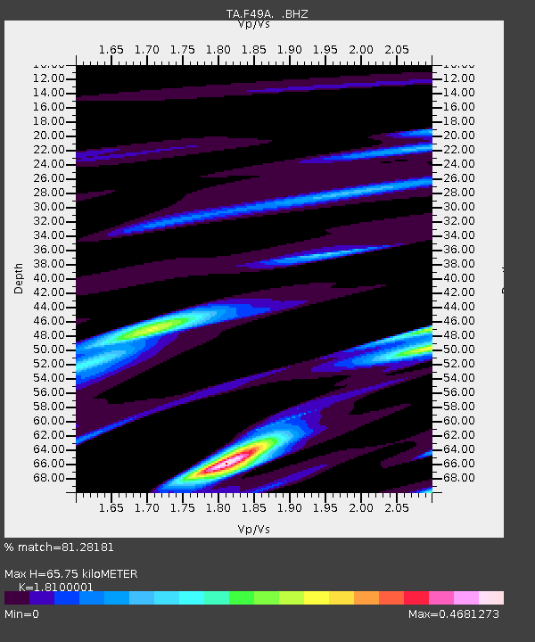
| Arrivals | |
| Ps | 8.6 SECOND |
| PpPs | 27 SECOND |
| PsPs/PpSs | 36 SECOND |

