You are here: Home > Network List > US - United States National Seismic Network Stations List
> Station MSO Missoula, Montana, USA > Earthquake Result Viewer
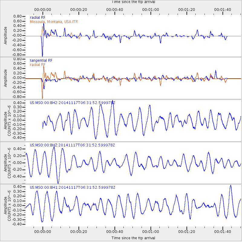
MSO Missoula, Montana, USA - Earthquake Result Viewer
*The percent match for this event was below the threshold and hence no stack was calculated.
| Earthquake location: |
Fiji Islands Region |
| Earthquake latitude/longitude: |
-21.6/-179.2 |
| Earthquake time(UTC): |
2014/11/17 (321) 06:20:29 GMT |
| Earthquake Depth: |
614 km |
| Earthquake Magnitude: |
5.5 MW, 4.8 mb |
| Earthquake Catalog/Contributor: |
ISC/ISC |
|
| Network: |
US United States National Seismic Network |
| Station: |
MSO Missoula, Montana, USA |
| Lat/Lon: |
46.83 N/113.94 W |
| Elevation: |
1264 m |
|
| Distance: |
89.9 deg |
| Az: |
38.579 deg |
| Baz: |
237.715 deg |
| Ray Param: |
$rayparam |
*The percent match for this event was below the threshold and hence was not used in the summary stack. |
|
| Radial Match: |
67.72074 % |
| Radial Bump: |
400 |
| Transverse Match: |
71.94625 % |
| Transverse Bump: |
400 |
| SOD ConfigId: |
3390531 |
| Insert Time: |
2019-04-15 01:29:46.219 +0000 |
| GWidth: |
2.5 |
| Max Bumps: |
400 |
| Tol: |
0.001 |
|
Signal To Noise
| Channel | StoN | STA | LTA |
| US:MSO:00:BHZ:20141117T06:31:52.599978Z | 1.452346 | 2.411452E-7 | 1.6603839E-7 |
| US:MSO:00:BH1:20141117T06:31:52.599978Z | 3.4367206 | 2.3041956E-7 | 6.704635E-8 |
| US:MSO:00:BH2:20141117T06:31:52.599978Z | 2.115573 | 2.667494E-7 | 1.2608848E-7 |
| Arrivals |
| Ps | |
| PpPs | |
| PsPs/PpSs | |


