O02D Mt. Diablo Meridian, CA, USA - Earthquake Result Viewer
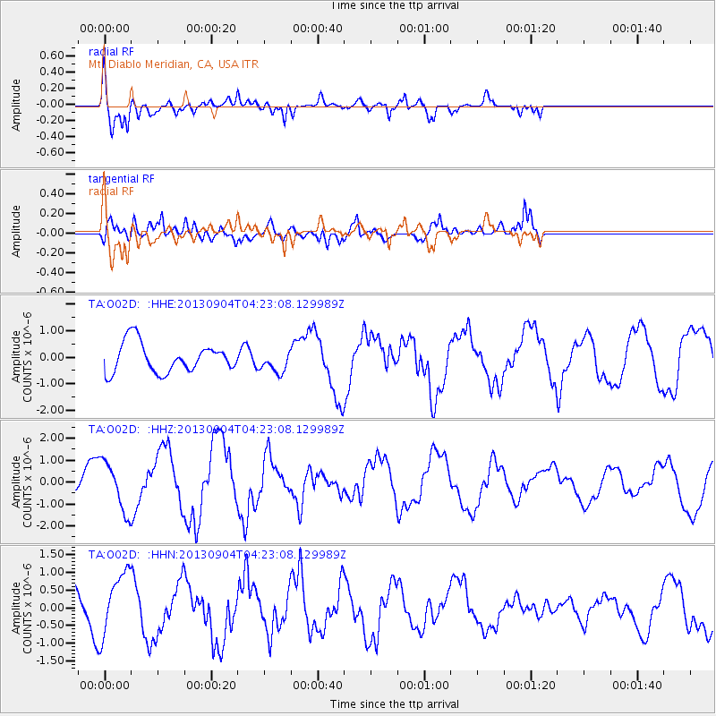
Earthquake location: Andreanof Islands, Aleutian Is.
Earthquake latitude/longitude: 51.4/-174.7
Earthquake time(UTC): 2013/09/04 (247) 04:16:30 GMT
Earthquake Depth: 27 km
Earthquake Magnitude: 5.9 MW, 5.2 ML, 5.4 ML, 5.8 MWW, 5.8 MWW, 5.9 MWC
Earthquake Catalog/Contributor: NEIC PDE/NEIC COMCAT
Network: TA USArray Transportable Network (new EarthScope stations)
Station: O02D Mt. Diablo Meridian, CA, USA
Lat/Lon: 40.18 N/122.79 W
Elevation: 965 m
Distance: 37.2 deg
Az: 86.812 deg
Baz: 305.367 deg
Ray Param: 0.07624169
Estimated Moho Depth: 66.0 km
Estimated Crust Vp/Vs: 1.71
Assumed Crust Vp: 6.566 km/s
Estimated Crust Vs: 3.851 km/s
Estimated Crust Poisson's Ratio: 0.24
Radial Match: 80.52188 %
Radial Bump: 400
Transverse Match: 61.723755 %
Transverse Bump: 400
SOD ConfigId: 626651
Insert Time: 2014-04-18 10:50:00.919 +0000
GWidth: 2.5
Max Bumps: 400
Tol: 0.001

Signal To Noise

ChannelStoNSTALTA
TA:O02D: :HHZ:20130904T04:23:08.129989Z1.33500931.1142365E-68.346282E-7
TA:O02D: :HHN:20130904T04:23:08.129989Z2.0337078.935802E-74.3938493E-7
TA:O02D: :HHE:20130904T04:23:08.129989Z0.74428514.1150798E-75.528903E-7
Arrivals
Ps7.7 SECOND
PpPs25 SECOND
PsPs/PpSs33 SECOND