You are here: Home > Network List > UW - Pacific Northwest Regional Seismic Network Stations List
> Station LEBA Lebam, WA, USA > Earthquake Result Viewer
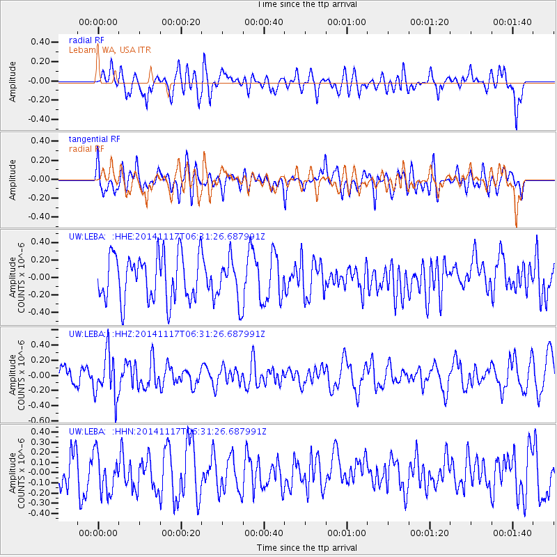
LEBA Lebam, WA, USA - Earthquake Result Viewer
*The percent match for this event was below the threshold and hence no stack was calculated.
| Earthquake location: |
Fiji Islands Region |
| Earthquake latitude/longitude: |
-21.6/-179.2 |
| Earthquake time(UTC): |
2014/11/17 (321) 06:20:29 GMT |
| Earthquake Depth: |
614 km |
| Earthquake Magnitude: |
5.5 MW, 4.8 mb |
| Earthquake Catalog/Contributor: |
ISC/ISC |
|
| Network: |
UW Pacific Northwest Regional Seismic Network |
| Station: |
LEBA Lebam, WA, USA |
| Lat/Lon: |
46.55 N/123.56 W |
| Elevation: |
73 m |
|
| Distance: |
84.4 deg |
| Az: |
34.926 deg |
| Baz: |
230.545 deg |
| Ray Param: |
$rayparam |
*The percent match for this event was below the threshold and hence was not used in the summary stack. |
|
| Radial Match: |
56.53488 % |
| Radial Bump: |
400 |
| Transverse Match: |
53.28481 % |
| Transverse Bump: |
400 |
| SOD ConfigId: |
3390531 |
| Insert Time: |
2019-04-15 01:29:58.373 +0000 |
| GWidth: |
2.5 |
| Max Bumps: |
400 |
| Tol: |
0.001 |
|
Signal To Noise
| Channel | StoN | STA | LTA |
| UW:LEBA: :HHZ:20141117T06:31:26.687991Z | 2.0339098 | 3.0092482E-7 | 1.4795387E-7 |
| UW:LEBA: :HHN:20141117T06:31:26.687991Z | 1.0338216 | 1.9536057E-7 | 1.8896932E-7 |
| UW:LEBA: :HHE:20141117T06:31:26.687991Z | 0.94726 | 2.4689672E-7 | 2.6064302E-7 |
| Arrivals |
| Ps | |
| PpPs | |
| PsPs/PpSs | |


