You are here: Home > Network List > IU - Global Seismograph Network (GSN - IRIS/USGS) Stations List
> Station XMAS Kiritimati Island, Republic of Kiribati > Earthquake Result Viewer
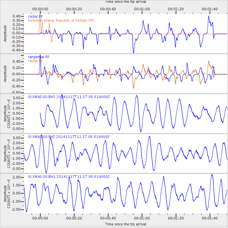
XMAS Kiritimati Island, Republic of Kiribati - Earthquake Result Viewer
*The percent match for this event was below the threshold and hence no stack was calculated.
| Earthquake location: |
Southeast Of Easter Island |
| Earthquake latitude/longitude: |
-36.0/-102.2 |
| Earthquake time(UTC): |
2014/11/17 (321) 11:27:05 GMT |
| Earthquake Depth: |
10 km |
| Earthquake Magnitude: |
5.4 MW, 5.0 mb, 4.7 MS |
| Earthquake Catalog/Contributor: |
ISC/ISC |
|
| Network: |
IU Global Seismograph Network (GSN - IRIS/USGS) |
| Station: |
XMAS Kiritimati Island, Republic of Kiribati |
| Lat/Lon: |
2.04 N/157.45 W |
| Elevation: |
20 m |
|
| Distance: |
63.8 deg |
| Az: |
293.82 deg |
| Baz: |
132.047 deg |
| Ray Param: |
$rayparam |
*The percent match for this event was below the threshold and hence was not used in the summary stack. |
|
| Radial Match: |
55.87098 % |
| Radial Bump: |
400 |
| Transverse Match: |
49.394558 % |
| Transverse Bump: |
400 |
| SOD ConfigId: |
3390531 |
| Insert Time: |
2019-04-15 01:33:32.532 +0000 |
| GWidth: |
2.5 |
| Max Bumps: |
400 |
| Tol: |
0.001 |
|
Signal To Noise
| Channel | StoN | STA | LTA |
| IU:XMAS:00:BHZ:20141117T11:37:06.619009Z | 3.0230043 | 2.5054403E-6 | 8.287915E-7 |
| IU:XMAS:00:BH1:20141117T11:37:06.619009Z | 1.1557233 | 1.0054795E-6 | 8.700001E-7 |
| IU:XMAS:00:BH2:20141117T11:37:06.619009Z | 0.3455333 | 6.196132E-7 | 1.7932083E-6 |
| Arrivals |
| Ps | |
| PpPs | |
| PsPs/PpSs | |


