You are here: Home > Network List > TA - USArray Transportable Network (new EarthScope stations) Stations List
> Station G59A Clarenceville, QC, USA > Earthquake Result Viewer
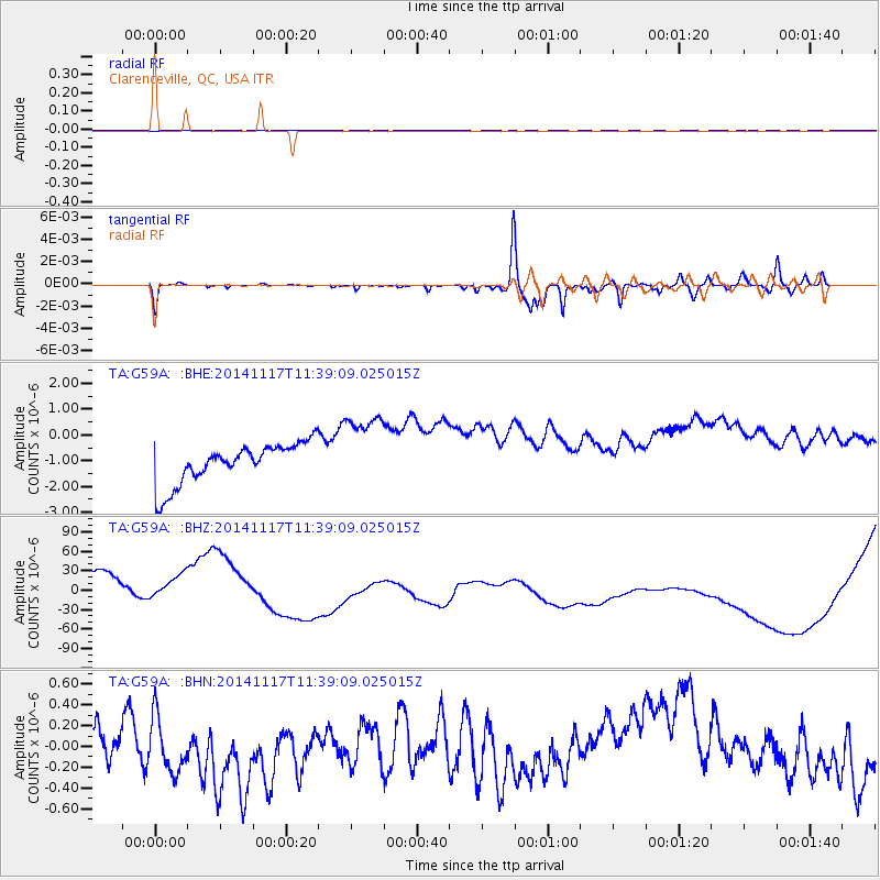
G59A Clarenceville, QC, USA - Earthquake Result Viewer
*The percent match for this event was below the threshold and hence no stack was calculated.
| Earthquake location: |
Southeast Of Easter Island |
| Earthquake latitude/longitude: |
-36.0/-102.2 |
| Earthquake time(UTC): |
2014/11/17 (321) 11:27:05 GMT |
| Earthquake Depth: |
10 km |
| Earthquake Magnitude: |
5.4 MW, 5.0 mb, 4.7 MS |
| Earthquake Catalog/Contributor: |
ISC/ISC |
|
| Network: |
TA USArray Transportable Network (new EarthScope stations) |
| Station: |
G59A Clarenceville, QC, USA |
| Lat/Lon: |
45.08 N/73.18 W |
| Elevation: |
36 m |
|
| Distance: |
84.9 deg |
| Az: |
20.219 deg |
| Baz: |
203.312 deg |
| Ray Param: |
$rayparam |
*The percent match for this event was below the threshold and hence was not used in the summary stack. |
|
| Radial Match: |
62.036186 % |
| Radial Bump: |
400 |
| Transverse Match: |
74.06762 % |
| Transverse Bump: |
231 |
| SOD ConfigId: |
3390531 |
| Insert Time: |
2019-04-15 01:35:42.988 +0000 |
| GWidth: |
2.5 |
| Max Bumps: |
400 |
| Tol: |
0.001 |
|
Signal To Noise
| Channel | StoN | STA | LTA |
| TA:G59A: :BHZ:20141117T11:39:09.025015Z | 0.52440107 | 2.0367263E-5 | 3.8839094E-5 |
| TA:G59A: :BHN:20141117T11:39:09.025015Z | 0.82632715 | 4.0958662E-7 | 4.9567126E-7 |
| TA:G59A: :BHE:20141117T11:39:09.025015Z | 1.9725053 | 1.5384353E-6 | 7.7993974E-7 |
| Arrivals |
| Ps | |
| PpPs | |
| PsPs/PpSs | |


