ARU Arti, Russia - Earthquake Result Viewer
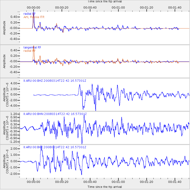
Earthquake location: Bonin Islands, Japan Region
Earthquake latitude/longitude: 27.0/142.6
Earthquake time(UTC): 2008/03/14 (074) 22:32:09 GMT
Earthquake Depth: 11 km
Earthquake Magnitude: 5.7 MB, 5.9 MS, 6.0 MW, 6.0 MW
Earthquake Catalog/Contributor: WHDF/NEIC
Network: II Global Seismograph Network (GSN - IRIS/IDA)
Station: ARU Arti, Russia
Lat/Lon: 56.43 N/58.56 E
Elevation: 250 m
Distance: 64.7 deg
Az: 322.34 deg
Baz: 78.929 deg
Ray Param: 0.0587305
Estimated Moho Depth: 38.75 km
Estimated Crust Vp/Vs: 1.70
Assumed Crust Vp: 6.159 km/s
Estimated Crust Vs: 3.617 km/s
Estimated Crust Poisson's Ratio: 0.24
Radial Match: 96.224495 %
Radial Bump: 361
Transverse Match: 90.91534 %
Transverse Bump: 400
SOD ConfigId: 2564
Insert Time: 2010-03-01 16:36:18.926 +0000
GWidth: 2.5
Max Bumps: 400
Tol: 0.001

Signal To Noise

ChannelStoNSTALTA
II:ARU:00:BHN:20080314T22:42:16.57301Z2.08739029.737782E-84.665051E-8
II:ARU:00:BHE:20080314T22:42:16.57301Z8.545766.2181323E-77.276278E-8
II:ARU:00:BHZ:20080314T22:42:16.57301Z19.2297131.6039165E-68.3408246E-8
Arrivals
Ps4.6 SECOND
PpPs16 SECOND
PsPs/PpSs21 SECOND