You are here: Home > Network List > TA - USArray Transportable Network (new EarthScope stations) Stations List
> Station S56A Natural Bridge, VA, USA > Earthquake Result Viewer
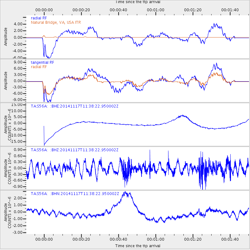
S56A Natural Bridge, VA, USA - Earthquake Result Viewer
*The percent match for this event was below the threshold and hence no stack was calculated.
| Earthquake location: |
Southeast Of Easter Island |
| Earthquake latitude/longitude: |
-36.0/-102.2 |
| Earthquake time(UTC): |
2014/11/17 (321) 11:27:05 GMT |
| Earthquake Depth: |
10 km |
| Earthquake Magnitude: |
5.4 MW, 5.0 mb, 4.7 MS |
| Earthquake Catalog/Contributor: |
ISC/ISC |
|
| Network: |
TA USArray Transportable Network (new EarthScope stations) |
| Station: |
S56A Natural Bridge, VA, USA |
| Lat/Lon: |
37.68 N/79.57 W |
| Elevation: |
449 m |
|
| Distance: |
76.2 deg |
| Az: |
18.362 deg |
| Baz: |
198.789 deg |
| Ray Param: |
$rayparam |
*The percent match for this event was below the threshold and hence was not used in the summary stack. |
|
| Radial Match: |
51.447132 % |
| Radial Bump: |
400 |
| Transverse Match: |
47.972927 % |
| Transverse Bump: |
400 |
| SOD ConfigId: |
3390531 |
| Insert Time: |
2019-04-15 01:36:10.413 +0000 |
| GWidth: |
2.5 |
| Max Bumps: |
400 |
| Tol: |
0.001 |
|
Signal To Noise
| Channel | StoN | STA | LTA |
| TA:S56A: :BHZ:20141117T11:38:22.950002Z | 0.8628279 | 1.7553928E-7 | 2.0344646E-7 |
| TA:S56A: :BHN:20141117T11:38:22.950002Z | 0.5943577 | 6.19796E-7 | 1.0427996E-6 |
| TA:S56A: :BHE:20141117T11:38:22.950002Z | 0.81234664 | 4.4643357E-6 | 5.4956045E-6 |
| Arrivals |
| Ps | |
| PpPs | |
| PsPs/PpSs | |


