157A Early Branch, SC, USA - Earthquake Result Viewer
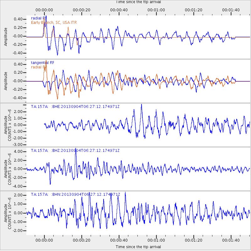
Earthquake location: Andreanof Islands, Aleutian Is.
Earthquake latitude/longitude: 51.6/-174.8
Earthquake time(UTC): 2013/09/04 (247) 06:16:49 GMT
Earthquake Depth: 21 km
Earthquake Magnitude: 5.7 MWW, 5.5 ML, 5.5 MI, 5.7 MWB, 5.7 MWW, 5.8 MWC
Earthquake Catalog/Contributor: NEIC PDE/NEIC COMCAT
Network: TA USArray Transportable Network (new EarthScope stations)
Station: 157A Early Branch, SC, USA
Lat/Lon: 32.68 N/81.00 W
Elevation: 21 m
Distance: 67.4 deg
Az: 65.759 deg
Baz: 317.566 deg
Ray Param: 0.05698922
Estimated Moho Depth: 13.5 km
Estimated Crust Vp/Vs: 1.60
Assumed Crust Vp: 6.565 km/s
Estimated Crust Vs: 4.103 km/s
Estimated Crust Poisson's Ratio: 0.18
Radial Match: 85.95113 %
Radial Bump: 400
Transverse Match: 69.97854 %
Transverse Bump: 400
SOD ConfigId: 626651
Insert Time: 2014-04-18 11:15:49.108 +0000
GWidth: 2.5
Max Bumps: 400
Tol: 0.001

Signal To Noise

ChannelStoNSTALTA
TA:157A: :BHZ:20130904T06:27:12.174971Z6.06056261.1762528E-61.9408309E-7
TA:157A: :BHN:20130904T06:27:12.174971Z1.39997384.0890956E-72.920837E-7
TA:157A: :BHE:20130904T06:27:12.174971Z1.37408615.293353E-73.8522714E-7
Arrivals
Ps1.3 SECOND
PpPs5.1 SECOND
PsPs/PpSs6.4 SECOND