You are here: Home > Network List > TA - USArray Transportable Network (new EarthScope stations) Stations List
> Station 833A Chaparral WMA, Artesia Wells, TX, USA > Earthquake Result Viewer
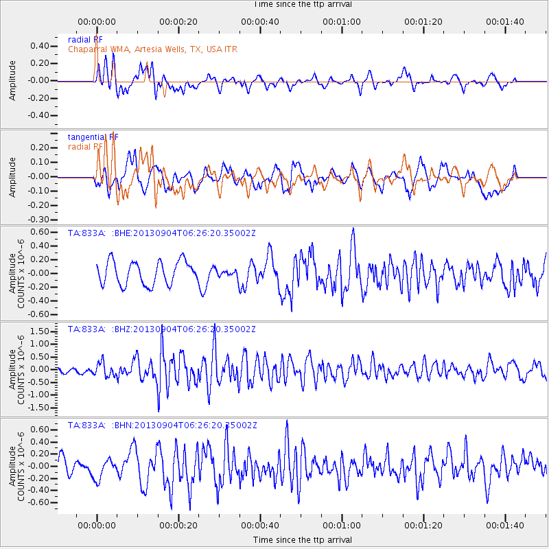
833A Chaparral WMA, Artesia Wells, TX, USA - Earthquake Result Viewer
*The percent match for this event was below the threshold and hence no stack was calculated.
| Earthquake location: |
Andreanof Islands, Aleutian Is. |
| Earthquake latitude/longitude: |
51.6/-174.8 |
| Earthquake time(UTC): |
2013/09/04 (247) 06:16:49 GMT |
| Earthquake Depth: |
21 km |
| Earthquake Magnitude: |
5.7 MWW, 5.5 ML, 5.5 MI, 5.7 MWB, 5.7 MWW, 5.8 MWC |
| Earthquake Catalog/Contributor: |
NEIC PDE/NEIC COMCAT |
|
| Network: |
TA USArray Transportable Network (new EarthScope stations) |
| Station: |
833A Chaparral WMA, Artesia Wells, TX, USA |
| Lat/Lon: |
28.32 N/99.39 W |
| Elevation: |
171 m |
|
| Distance: |
59.5 deg |
| Az: |
81.937 deg |
| Baz: |
315.502 deg |
| Ray Param: |
$rayparam |
*The percent match for this event was below the threshold and hence was not used in the summary stack. |
|
| Radial Match: |
64.57762 % |
| Radial Bump: |
400 |
| Transverse Match: |
54.44069 % |
| Transverse Bump: |
400 |
| SOD ConfigId: |
626651 |
| Insert Time: |
2014-04-18 11:16:41.733 +0000 |
| GWidth: |
2.5 |
| Max Bumps: |
400 |
| Tol: |
0.001 |
|
Signal To Noise
| Channel | StoN | STA | LTA |
| TA:833A: :BHZ:20130904T06:26:20.35002Z | 3.2381468 | 2.7108118E-7 | 8.3714916E-8 |
| TA:833A: :BHN:20130904T06:26:20.35002Z | 1.2535517 | 1.6441777E-7 | 1.3116154E-7 |
| TA:833A: :BHE:20130904T06:26:20.35002Z | 0.33103997 | 5.5907993E-8 | 1.6888593E-7 |
| Arrivals |
| Ps | |
| PpPs | |
| PsPs/PpSs | |


