A04D Lummi Island, WA, USA - Earthquake Result Viewer
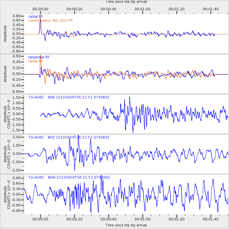
Earthquake location: Andreanof Islands, Aleutian Is.
Earthquake latitude/longitude: 51.6/-174.8
Earthquake time(UTC): 2013/09/04 (247) 06:16:49 GMT
Earthquake Depth: 21 km
Earthquake Magnitude: 5.7 MWW, 5.5 ML, 5.5 MI, 5.7 MWB, 5.7 MWW, 5.8 MWC
Earthquake Catalog/Contributor: NEIC PDE/NEIC COMCAT
Network: TA USArray Transportable Network (new EarthScope stations)
Station: A04D Lummi Island, WA, USA
Lat/Lon: 48.72 N/122.71 W
Elevation: 13 m
Distance: 32.9 deg
Az: 74.018 deg
Baz: 295.049 deg
Ray Param: 0.07842365
Estimated Moho Depth: 31.0 km
Estimated Crust Vp/Vs: 1.86
Assumed Crust Vp: 6.566 km/s
Estimated Crust Vs: 3.53 km/s
Estimated Crust Poisson's Ratio: 0.30
Radial Match: 81.582344 %
Radial Bump: 400
Transverse Match: 60.393303 %
Transverse Bump: 400
SOD ConfigId: 626651
Insert Time: 2014-04-18 11:16:47.453 +0000
GWidth: 2.5
Max Bumps: 400
Tol: 0.001

Signal To Noise

ChannelStoNSTALTA
TA:A04D: :BHZ:20130904T06:22:51.974989Z2.82863334.9467883E-71.7488263E-7
TA:A04D: :BHN:20130904T06:22:51.974989Z0.819402161.7542332E-72.1408697E-7
TA:A04D: :BHE:20130904T06:22:51.974989Z1.80267662.6423584E-71.4657972E-7
Arrivals
Ps4.4 SECOND
PpPs12 SECOND
PsPs/PpSs17 SECOND