
I41A Arkdale, WI, USA - Earthquake Result Viewer
| ||||||||||||||||||
| ||||||||||||||||||
| ||||||||||||||||||
|

Signal To Noise
| Channel | StoN | STA | LTA |
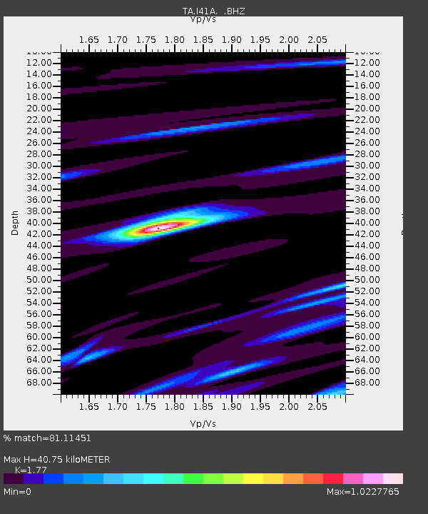
| TA:I41A: :BHZ:20130904T06:25:44.674971Z | 7.2534847 | 8.8227773E-7 | 1.2163501E-7 |
| TA:I41A: :BHN:20130904T06:25:44.674971Z | 2.254505 | 2.3429384E-7 | 1.03922524E-7 |
| TA:I41A: :BHE:20130904T06:25:44.674971Z | 3.152235 | 3.5377786E-7 | 1.122308E-7 |
| Arrivals | |
| Ps | 5.2 SECOND |
| PpPs | 17 SECOND |
| PsPs/PpSs | 22 SECOND |

