
M49A Liberty Center, OH, USA - Earthquake Result Viewer
| ||||||||||||||||||
| ||||||||||||||||||
| ||||||||||||||||||
|
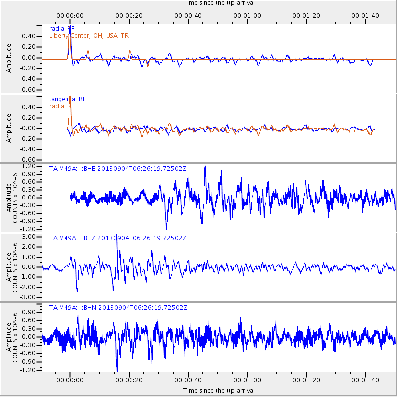
Signal To Noise
| Channel | StoN | STA | LTA |
| TA:M49A: :BHZ:20130904T06:26:19.72502Z | 6.05823 | 8.39131E-7 | 1.3851093E-7 |
| TA:M49A: :BHN:20130904T06:26:19.72502Z | 1.7784718 | 3.0292992E-7 | 1.7033159E-7 |
| TA:M49A: :BHE:20130904T06:26:19.72502Z | 2.905524 | 4.1449871E-7 | 1.4265885E-7 |
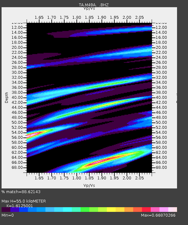
| Arrivals | |
| Ps | 5.5 SECOND |
| PpPs | 21 SECOND |
| PsPs/PpSs | 26 SECOND |

