N47A Urbana, IN, USA - Earthquake Result Viewer
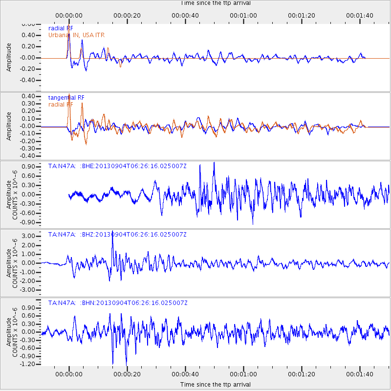
Earthquake location: Andreanof Islands, Aleutian Is.
Earthquake latitude/longitude: 51.6/-174.8
Earthquake time(UTC): 2013/09/04 (247) 06:16:49 GMT
Earthquake Depth: 21 km
Earthquake Magnitude: 5.7 MWW, 5.5 ML, 5.5 MI, 5.7 MWB, 5.7 MWW, 5.8 MWC
Earthquake Catalog/Contributor: NEIC PDE/NEIC COMCAT
Network: TA USArray Transportable Network (new EarthScope stations)
Station: N47A Urbana, IN, USA
Lat/Lon: 40.88 N/85.69 W
Elevation: 252 m
Distance: 58.9 deg
Az: 62.331 deg
Baz: 313.203 deg
Ray Param: 0.06253364
Estimated Moho Depth: 26.75 km
Estimated Crust Vp/Vs: 2.07
Assumed Crust Vp: 6.498 km/s
Estimated Crust Vs: 3.139 km/s
Estimated Crust Poisson's Ratio: 0.35
Radial Match: 80.97314 %
Radial Bump: 400
Transverse Match: 66.44047 %
Transverse Bump: 400
SOD ConfigId: 626651
Insert Time: 2014-04-18 11:23:08.589 +0000
GWidth: 2.5
Max Bumps: 400
Tol: 0.001

Signal To Noise

ChannelStoNSTALTA
TA:N47A: :BHZ:20130904T06:26:16.025007Z4.14868356.4129324E-71.5457753E-7
TA:N47A: :BHN:20130904T06:26:16.025007Z2.03797942.688245E-71.3190737E-7
TA:N47A: :BHE:20130904T06:26:16.025007Z2.69587762.894493E-71.0736737E-7
Arrivals
Ps4.6 SECOND
PpPs12 SECOND
PsPs/PpSs17 SECOND