R53A Hurricane, WV, USA - Earthquake Result Viewer
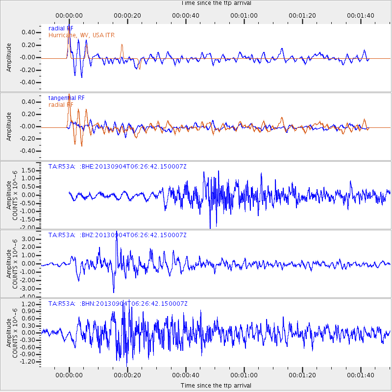
Earthquake location: Andreanof Islands, Aleutian Is.
Earthquake latitude/longitude: 51.6/-174.8
Earthquake time(UTC): 2013/09/04 (247) 06:16:49 GMT
Earthquake Depth: 21 km
Earthquake Magnitude: 5.7 MWW, 5.5 ML, 5.5 MI, 5.7 MWB, 5.7 MWW, 5.8 MWC
Earthquake Catalog/Contributor: NEIC PDE/NEIC COMCAT
Network: TA USArray Transportable Network (new EarthScope stations)
Station: R53A Hurricane, WV, USA
Lat/Lon: 38.33 N/81.95 W
Elevation: 294 m
Distance: 62.7 deg
Az: 62.102 deg
Baz: 315.469 deg
Ray Param: 0.06001613
Estimated Moho Depth: 19.25 km
Estimated Crust Vp/Vs: 2.01
Assumed Crust Vp: 6.207 km/s
Estimated Crust Vs: 3.088 km/s
Estimated Crust Poisson's Ratio: 0.34
Radial Match: 84.75857 %
Radial Bump: 400
Transverse Match: 76.71407 %
Transverse Bump: 400
SOD ConfigId: 626651
Insert Time: 2014-04-18 11:25:39.637 +0000
GWidth: 2.5
Max Bumps: 400
Tol: 0.001

Signal To Noise

ChannelStoNSTALTA
TA:R53A: :BHZ:20130904T06:26:42.150007Z5.72181758.2549064E-71.4427071E-7
TA:R53A: :BHN:20130904T06:26:42.150007Z3.16629033.0844228E-79.741441E-8
TA:R53A: :BHE:20130904T06:26:42.150007Z2.59813553.5777268E-71.3770362E-7
Arrivals
Ps3.2 SECOND
PpPs9.0 SECOND
PsPs/PpSs12 SECOND