
S57A Dark Hollow, Roseland, VA, USA - Earthquake Result Viewer
| ||||||||||||||||||
| ||||||||||||||||||
| ||||||||||||||||||
|
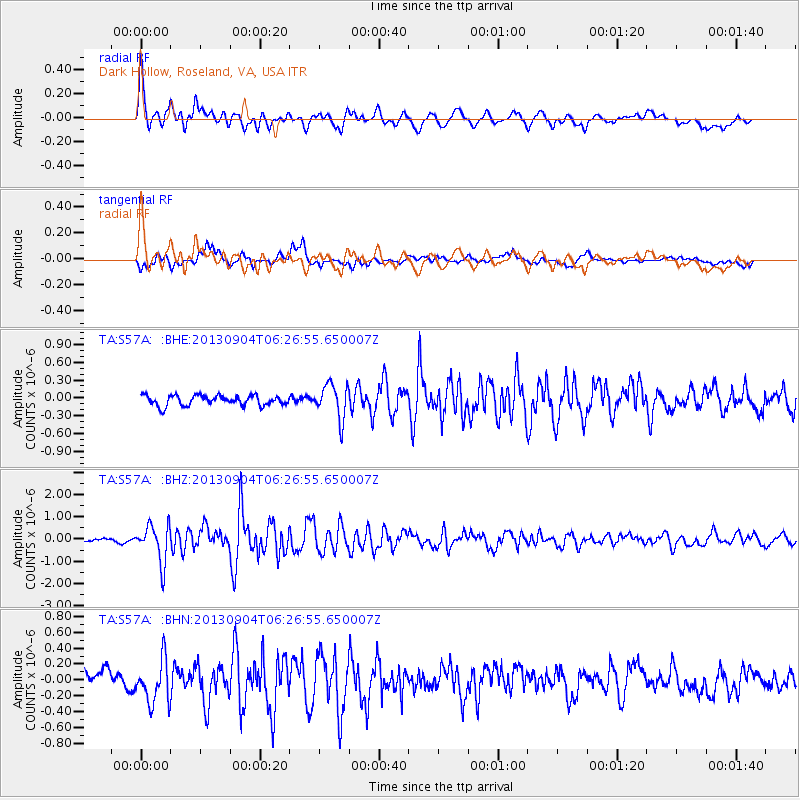
Signal To Noise
| Channel | StoN | STA | LTA |
| TA:S57A: :BHZ:20130904T06:26:55.650007Z | 6.605102 | 8.470027E-7 | 1.2823462E-7 |
| TA:S57A: :BHN:20130904T06:26:55.650007Z | 2.7917376 | 2.7354312E-7 | 9.798311E-8 |
| TA:S57A: :BHE:20130904T06:26:55.650007Z | 3.4257858 | 2.8975313E-7 | 8.4580044E-8 |
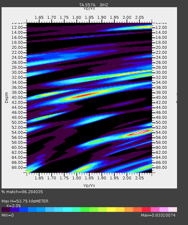
| Arrivals | |
| Ps | 9.1 SECOND |
| PpPs | 25 SECOND |
| PsPs/PpSs | 34 SECOND |

