
T47A Sharon Grove, KY, USA - Earthquake Result Viewer
| ||||||||||||||||||
| ||||||||||||||||||
| ||||||||||||||||||
|
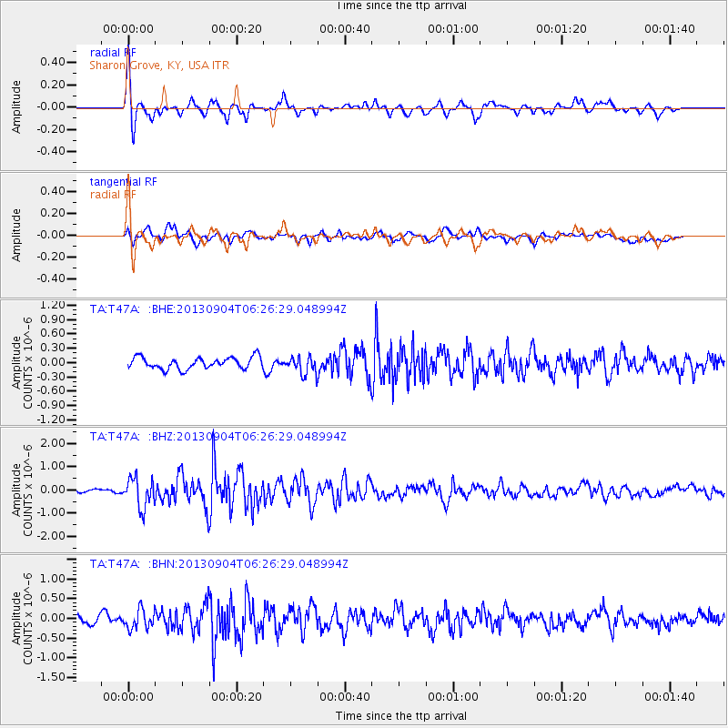
Signal To Noise
| Channel | StoN | STA | LTA |
| TA:T47A: :BHZ:20130904T06:26:29.048994Z | 4.1065736 | 6.420629E-7 | 1.5635003E-7 |
| TA:T47A: :BHN:20130904T06:26:29.048994Z | 1.892181 | 2.5153417E-7 | 1.3293347E-7 |
| TA:T47A: :BHE:20130904T06:26:29.048994Z | 1.5318912 | 1.851121E-7 | 1.2083893E-7 |
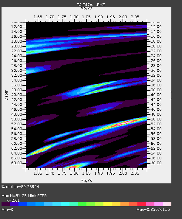
| Arrivals | |
| Ps | 8.4 SECOND |
| PpPs | 23 SECOND |
| PsPs/PpSs | 31 SECOND |

