TUL1 Leonard, OK, USA - Earthquake Result Viewer
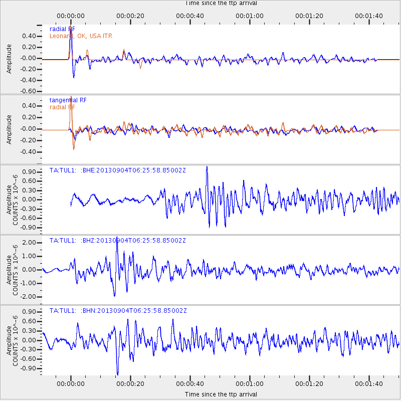
Earthquake location: Andreanof Islands, Aleutian Is.
Earthquake latitude/longitude: 51.6/-174.8
Earthquake time(UTC): 2013/09/04 (247) 06:16:49 GMT
Earthquake Depth: 21 km
Earthquake Magnitude: 5.7 MWW, 5.5 ML, 5.5 MI, 5.7 MWB, 5.7 MWW, 5.8 MWC
Earthquake Catalog/Contributor: NEIC PDE/NEIC COMCAT
Network: TA USArray Transportable Network (new EarthScope stations)
Station: TUL1 Leonard, OK, USA
Lat/Lon: 35.91 N/95.79 W
Elevation: 256 m
Distance: 56.4 deg
Az: 73.018 deg
Baz: 312.673 deg
Ray Param: 0.064121194
Estimated Moho Depth: 47.25 km
Estimated Crust Vp/Vs: 1.62
Assumed Crust Vp: 6.498 km/s
Estimated Crust Vs: 4.017 km/s
Estimated Crust Poisson's Ratio: 0.19
Radial Match: 86.30943 %
Radial Bump: 400
Transverse Match: 66.92909 %
Transverse Bump: 400
SOD ConfigId: 626651
Insert Time: 2014-04-18 11:27:18.718 +0000
GWidth: 2.5
Max Bumps: 400
Tol: 0.001

Signal To Noise

ChannelStoNSTALTA
TA:TUL1: :BHZ:20130904T06:25:58.85002Z4.31215524.6998176E-71.0898999E-7
TA:TUL1: :BHN:20130904T06:25:58.85002Z2.36105942.2675025E-79.60375E-8
TA:TUL1: :BHE:20130904T06:25:58.85002Z2.73968342.4224997E-78.842262E-8
Arrivals
Ps4.8 SECOND
PpPs18 SECOND
PsPs/PpSs23 SECOND