
U55A TA2, Sparta, NC, USA - Earthquake Result Viewer
| ||||||||||||||||||
| ||||||||||||||||||
| ||||||||||||||||||
|
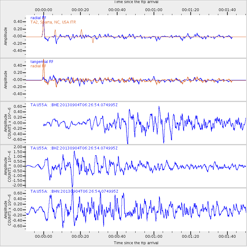
Signal To Noise
| Channel | StoN | STA | LTA |
| TA:U55A: :BHZ:20130904T06:26:54.074995Z | 4.947537 | 6.7678803E-7 | 1.3679292E-7 |
| TA:U55A: :BHN:20130904T06:26:54.074995Z | 3.658232 | 2.9533035E-7 | 8.073035E-8 |
| TA:U55A: :BHE:20130904T06:26:54.074995Z | 2.0173025 | 1.6215395E-7 | 8.038157E-8 |
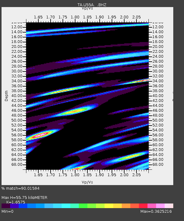
| Arrivals | |
| Ps | 6.2 SECOND |
| PpPs | 23 SECOND |
| PsPs/PpSs | 29 SECOND |

