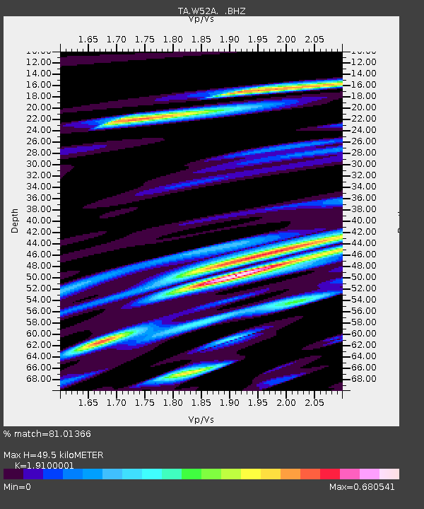
W52A Murphy, NC, USA - Earthquake Result Viewer
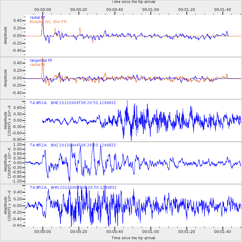
Earthquake location: Andreanof Islands, Aleutian Is.
Earthquake latitude/longitude: 51.6/-174.8
Earthquake time(UTC): 2013/09/04 (247) 06:16:49 GMT
Earthquake Depth: 21 km
Earthquake Magnitude: 5.7 MWW, 5.5 ML, 5.5 MI, 5.7 MWB, 5.7 MWW, 5.8 MWC
Earthquake Catalog/Contributor: NEIC PDE/NEIC COMCAT
Network: TA USArray Transportable Network (new EarthScope stations)
Station: W52A Murphy, NC, USA
Lat/Lon: 35.09 N/83.93 W
Elevation: 519 m
Distance: 63.9 deg
Az: 65.898 deg
Baz: 315.997 deg
Ray Param: 0.05923187
Estimated Moho Depth: 49.5 km
Estimated Crust Vp/Vs: 1.91
Assumed Crust Vp: 6.35 km/s
Estimated Crust Vs: 3.325 km/s
Estimated Crust Poisson's Ratio: 0.31
Radial Match: 81.01366 %
Radial Bump: 400
Transverse Match: 64.490944 %
Transverse Bump: 400
SOD ConfigId: 626651
Insert Time: 2014-04-18 11:28:37.429 +0000
GWidth: 2.5
Max Bumps: 400
Tol: 0.001

Signal To Noise

ChannelStoNSTALTA
TA:W52A: :BHZ:20130904T06:26:50.124983Z5.5353284.8162656E-78.700958E-8
TA:W52A: :BHN:20130904T06:26:50.124983Z2.43935442.4153883E-79.901753E-8
TA:W52A: :BHE:20130904T06:26:50.124983Z2.00277971.5802877E-77.890472E-8
Arrivals
Ps7.4 SECOND
PpPs22 SECOND
PsPs/PpSs29 SECOND