W53A Cullowhee, NC, USA - Earthquake Result Viewer
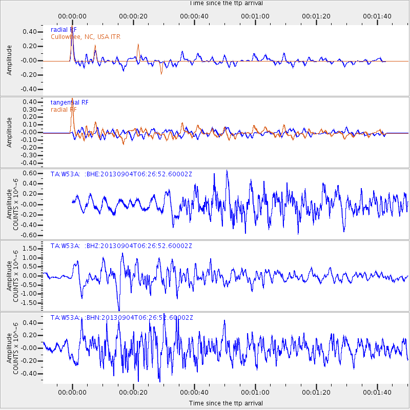
Earthquake location: Andreanof Islands, Aleutian Is.
Earthquake latitude/longitude: 51.6/-174.8
Earthquake time(UTC): 2013/09/04 (247) 06:16:49 GMT
Earthquake Depth: 21 km
Earthquake Magnitude: 5.7 MWW, 5.5 ML, 5.5 MI, 5.7 MWB, 5.7 MWW, 5.8 MWC
Earthquake Catalog/Contributor: NEIC PDE/NEIC COMCAT
Network: TA USArray Transportable Network (new EarthScope stations)
Station: W53A Cullowhee, NC, USA
Lat/Lon: 35.17 N/83.16 W
Elevation: 1180 m
Distance: 64.3 deg
Az: 65.338 deg
Baz: 316.19 deg
Ray Param: 0.05898192
Estimated Moho Depth: 54.5 km
Estimated Crust Vp/Vs: 1.86
Assumed Crust Vp: 6.35 km/s
Estimated Crust Vs: 3.419 km/s
Estimated Crust Poisson's Ratio: 0.30
Radial Match: 80.071 %
Radial Bump: 400
Transverse Match: 69.765686 %
Transverse Bump: 400
SOD ConfigId: 626651
Insert Time: 2014-04-18 11:28:39.976 +0000
GWidth: 2.5
Max Bumps: 400
Tol: 0.001

Signal To Noise

ChannelStoNSTALTA
TA:W53A: :BHZ:20130904T06:26:52.60002Z4.9263915.7925564E-71.1758214E-7
TA:W53A: :BHN:20130904T06:26:52.60002Z2.6307952.0274268E-77.706518E-8
TA:W53A: :BHE:20130904T06:26:52.60002Z2.37953542.2049927E-79.266484E-8
Arrivals
Ps7.7 SECOND
PpPs24 SECOND
PsPs/PpSs31 SECOND