You are here: Home > Network List > CI - Caltech Regional Seismic Network Stations List
> Station TIN Tinemaha, California, USA > Earthquake Result Viewer
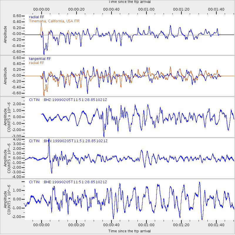
TIN Tinemaha, California, USA - Earthquake Result Viewer
*The percent match for this event was below the threshold and hence no stack was calculated.
| Earthquake location: |
Santa Cruz Islands |
| Earthquake latitude/longitude: |
-12.6/167.0 |
| Earthquake time(UTC): |
1999/02/05 (036) 11:39:45 GMT |
| Earthquake Depth: |
213 km |
| Earthquake Magnitude: |
5.7 MB, 6.0 MW, 5.9 MW |
| Earthquake Catalog/Contributor: |
WHDF/NEIC |
|
| Network: |
CI Caltech Regional Seismic Network |
| Station: |
TIN Tinemaha, California, USA |
| Lat/Lon: |
37.05 N/118.23 W |
| Elevation: |
1164 m |
|
| Distance: |
85.7 deg |
| Az: |
50.731 deg |
| Baz: |
250.849 deg |
| Ray Param: |
$rayparam |
*The percent match for this event was below the threshold and hence was not used in the summary stack. |
|
| Radial Match: |
52.435287 % |
| Radial Bump: |
400 |
| Transverse Match: |
80.423225 % |
| Transverse Bump: |
400 |
| SOD ConfigId: |
4480 |
| Insert Time: |
2010-02-25 20:51:50.966 +0000 |
| GWidth: |
2.5 |
| Max Bumps: |
400 |
| Tol: |
0.001 |
|
Signal To Noise
| Channel | StoN | STA | LTA |
| CI:TIN: :BHN:19990205T11:51:28.851021Z | 3.9339764 | 1.1858352E-6 | 3.0143426E-7 |
| CI:TIN: :BHE:19990205T11:51:28.851021Z | 0.7752013 | 3.6577748E-7 | 4.7184838E-7 |
| CI:TIN: :BHZ:19990205T11:51:28.851021Z | 1.2995495 | 6.241427E-7 | 4.802762E-7 |
| Arrivals |
| Ps | |
| PpPs | |
| PsPs/PpSs | |


