Y52A Lilburn, GA, USA - Earthquake Result Viewer
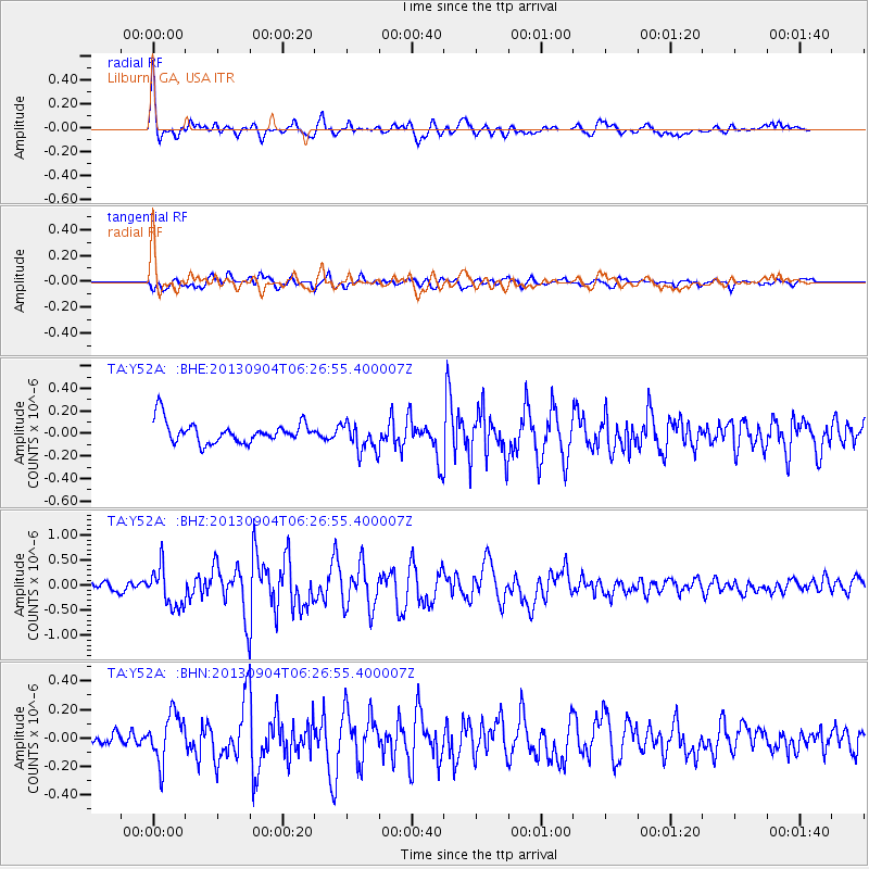
Earthquake location: Andreanof Islands, Aleutian Is.
Earthquake latitude/longitude: 51.6/-174.8
Earthquake time(UTC): 2013/09/04 (247) 06:16:49 GMT
Earthquake Depth: 21 km
Earthquake Magnitude: 5.7 MWW, 5.5 ML, 5.5 MI, 5.7 MWB, 5.7 MWW, 5.8 MWC
Earthquake Catalog/Contributor: NEIC PDE/NEIC COMCAT
Network: TA USArray Transportable Network (new EarthScope stations)
Station: Y52A Lilburn, GA, USA
Lat/Lon: 33.86 N/84.06 W
Elevation: 286 m
Distance: 64.7 deg
Az: 66.93 deg
Baz: 316.368 deg
Ray Param: 0.05870817
Estimated Moho Depth: 60.5 km
Estimated Crust Vp/Vs: 2.03
Assumed Crust Vp: 6.719 km/s
Estimated Crust Vs: 3.306 km/s
Estimated Crust Poisson's Ratio: 0.34
Radial Match: 83.38082 %
Radial Bump: 400
Transverse Match: 60.58956 %
Transverse Bump: 400
SOD ConfigId: 626651
Insert Time: 2014-04-18 11:29:39.506 +0000
GWidth: 2.5
Max Bumps: 400
Tol: 0.001

Signal To Noise

ChannelStoNSTALTA
TA:Y52A: :BHZ:20130904T06:26:55.400007Z4.0951963.9117648E-79.5520825E-8
TA:Y52A: :BHN:20130904T06:26:55.400007Z3.32928851.7004787E-75.107634E-8
TA:Y52A: :BHE:20130904T06:26:55.400007Z1.36717381.295658E-79.476908E-8
Arrivals
Ps9.7 SECOND
PpPs26 SECOND
PsPs/PpSs36 SECOND