Y55A Saluda, SC, USA - Earthquake Result Viewer
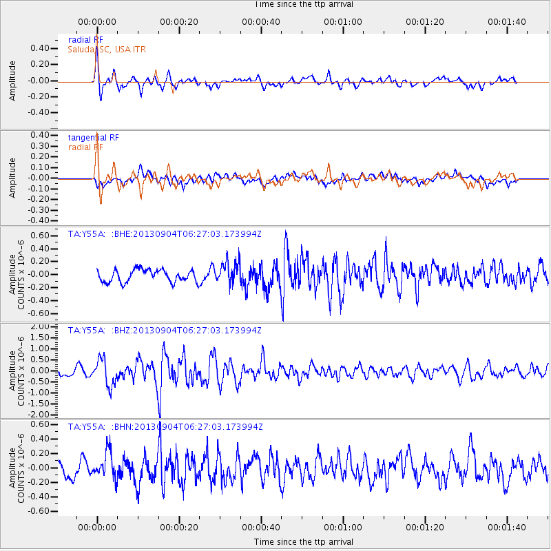
Earthquake location: Andreanof Islands, Aleutian Is.
Earthquake latitude/longitude: 51.6/-174.8
Earthquake time(UTC): 2013/09/04 (247) 06:16:49 GMT
Earthquake Depth: 21 km
Earthquake Magnitude: 5.7 MWW, 5.5 ML, 5.5 MI, 5.7 MWB, 5.7 MWW, 5.8 MWC
Earthquake Catalog/Contributor: NEIC PDE/NEIC COMCAT
Network: TA USArray Transportable Network (new EarthScope stations)
Station: Y55A Saluda, SC, USA
Lat/Lon: 33.94 N/81.86 W
Elevation: 164 m
Distance: 65.9 deg
Az: 65.407 deg
Baz: 316.956 deg
Ray Param: 0.057918284
Estimated Moho Depth: 29.25 km
Estimated Crust Vp/Vs: 1.84
Assumed Crust Vp: 6.565 km/s
Estimated Crust Vs: 3.573 km/s
Estimated Crust Poisson's Ratio: 0.29
Radial Match: 84.55364 %
Radial Bump: 400
Transverse Match: 59.958263 %
Transverse Bump: 400
SOD ConfigId: 626651
Insert Time: 2014-04-18 11:29:44.642 +0000
GWidth: 2.5
Max Bumps: 400
Tol: 0.001

Signal To Noise

ChannelStoNSTALTA
TA:Y55A: :BHZ:20130904T06:27:03.173994Z4.67184736.071747E-71.2996458E-7
TA:Y55A: :BHN:20130904T06:27:03.173994Z1.94421521.9110871E-79.829607E-8
TA:Y55A: :BHE:20130904T06:27:03.173994Z1.82986271.7234875E-79.41867E-8
Arrivals
Ps3.9 SECOND
PpPs12 SECOND
PsPs/PpSs16 SECOND