
ARU Arti, Russia - Earthquake Result Viewer
| ||||||||||||||||||
| ||||||||||||||||||
| ||||||||||||||||||
|
Signal To Noise
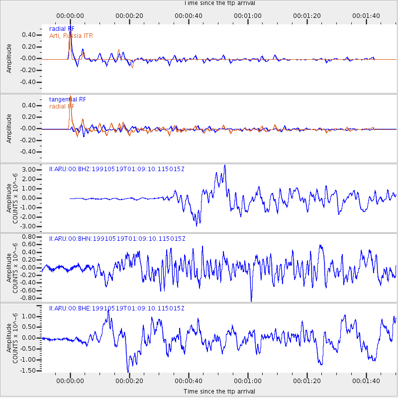
| Channel | StoN | STA | LTA |
| II:ARU:00:BHN:19910519T01:09:10.115015Z | 1.3815924 | 5.3166705E-8 | 3.848219E-8 |
| II:ARU:00:BHE:19910519T01:09:10.115015Z | 2.4049983 | 8.664455E-8 | 3.6026865E-8 |
| II:ARU:00:BHZ:19910519T01:09:10.115015Z | 2.1901102 | 1.1595029E-7 | 5.2942678E-8 |
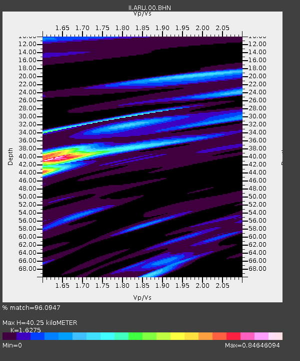
| Arrivals | |
| Ps | 4.2 SECOND |
| PpPs | 17 SECOND |
| PsPs/PpSs | 21 SECOND |

