You are here: Home > Network List > KN - Kyrgyz Seismic Telemetry Network Stations List
> Station CHM KN.CHM > Earthquake Result Viewer
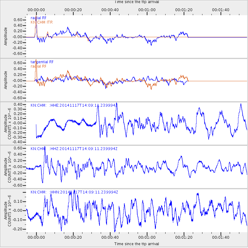
CHM KN.CHM - Earthquake Result Viewer
*The percent match for this event was below the threshold and hence no stack was calculated.
| Earthquake location: |
Philippine Islands Region |
| Earthquake latitude/longitude: |
19.5/120.4 |
| Earthquake time(UTC): |
2014/11/17 (321) 14:01:28 GMT |
| Earthquake Depth: |
13 km |
| Earthquake Magnitude: |
5.4 MW, 5.3 mb, 4.9 MS |
| Earthquake Catalog/Contributor: |
ISC/ISC |
|
| Network: |
KN Kyrgyz Seismic Telemetry Network |
| Station: |
CHM KN.CHM |
| Lat/Lon: |
43.00 N/74.75 E |
| Elevation: |
655 m |
|
| Distance: |
44.8 deg |
| Az: |
311.867 deg |
| Baz: |
106.803 deg |
| Ray Param: |
$rayparam |
*The percent match for this event was below the threshold and hence was not used in the summary stack. |
|
| Radial Match: |
66.52116 % |
| Radial Bump: |
400 |
| Transverse Match: |
58.8278 % |
| Transverse Bump: |
400 |
| SOD ConfigId: |
3390531 |
| Insert Time: |
2019-04-15 01:52:48.987 +0000 |
| GWidth: |
2.5 |
| Max Bumps: |
400 |
| Tol: |
0.001 |
|
Signal To Noise
| Channel | StoN | STA | LTA |
| KN:CHM: :HHZ:20141117T14:09:11.239994Z | 2.5820334 | 2.5554053E-7 | 9.896871E-8 |
| KN:CHM: :HHN:20141117T14:09:11.239994Z | 1.4005058 | 1.1114941E-7 | 7.936377E-8 |
| KN:CHM: :HHE:20141117T14:09:11.239994Z | 1.5502775 | 1.7619041E-7 | 1.1365089E-7 |
| Arrivals |
| Ps | |
| PpPs | |
| PsPs/PpSs | |


