You are here: Home > Network List > TA - USArray Transportable Network (new EarthScope stations) Stations List
> Station A21K Barrow, AK, USA > Earthquake Result Viewer
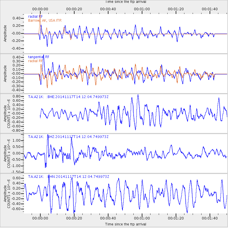
A21K Barrow, AK, USA - Earthquake Result Viewer
*The percent match for this event was below the threshold and hence no stack was calculated.
| Earthquake location: |
Philippine Islands Region |
| Earthquake latitude/longitude: |
19.5/120.4 |
| Earthquake time(UTC): |
2014/11/17 (321) 14:01:28 GMT |
| Earthquake Depth: |
13 km |
| Earthquake Magnitude: |
5.4 MW, 5.3 mb, 4.9 MS |
| Earthquake Catalog/Contributor: |
ISC/ISC |
|
| Network: |
TA USArray Transportable Network (new EarthScope stations) |
| Station: |
A21K Barrow, AK, USA |
| Lat/Lon: |
71.32 N/156.62 W |
| Elevation: |
577 m |
|
| Distance: |
69.4 deg |
| Az: |
19.976 deg |
| Baz: |
269.848 deg |
| Ray Param: |
$rayparam |
*The percent match for this event was below the threshold and hence was not used in the summary stack. |
|
| Radial Match: |
57.111256 % |
| Radial Bump: |
400 |
| Transverse Match: |
61.39005 % |
| Transverse Bump: |
338 |
| SOD ConfigId: |
3390531 |
| Insert Time: |
2019-04-15 01:53:41.740 +0000 |
| GWidth: |
2.5 |
| Max Bumps: |
400 |
| Tol: |
0.001 |
|
Signal To Noise
| Channel | StoN | STA | LTA |
| TA:A21K: :BHZ:20141117T14:12:04.749973Z | 3.9882812 | 6.037174E-7 | 1.5137283E-7 |
| TA:A21K: :BHN:20141117T14:12:04.749973Z | 0.93491185 | 2.2382234E-7 | 2.3940476E-7 |
| TA:A21K: :BHE:20141117T14:12:04.749973Z | 1.4964991 | 2.0965958E-7 | 1.4010004E-7 |
| Arrivals |
| Ps | |
| PpPs | |
| PsPs/PpSs | |


