CGRP Cima Grappa - Earthquake Result Viewer

*The percent match for this event was below the threshold and hence no stack was calculated.
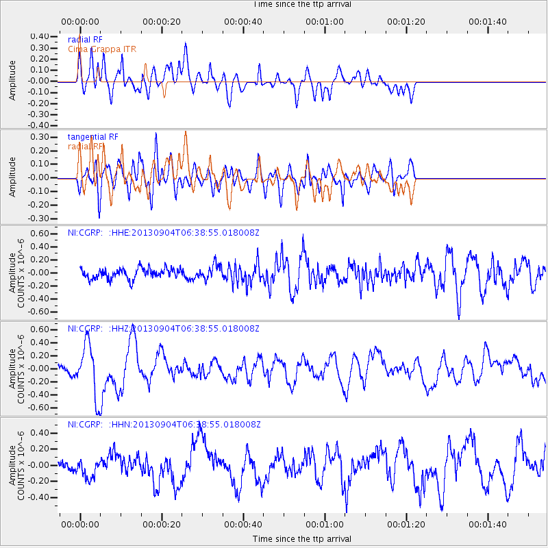
Earthquake location: Andreanof Islands, Aleutian Is.
Earthquake latitude/longitude: 51.6/-174.9
Earthquake time(UTC): 2013/09/04 (247) 06:27:03 GMT
Earthquake Depth: 17 km
Earthquake Magnitude: 6.0 MWW, 5.5 ML, 5.9 MWB, 6.0 MWW, 6.1 MWC, 6.1 MI
Earthquake Catalog/Contributor: NEIC PDE/NEIC COMCAT
Network: NI North-East Italy Broadband Network
Station: CGRP Cima Grappa
Lat/Lon: 45.88 N/11.80 E
Elevation: 1757 m

*The percent match for this event was below the threshold and hence was not used in the summary stack.

Distance: 82.8 deg
Az: 355.317 deg
Baz: 4.183 deg
Ray Param: $rayparam
Radial Match: 55.218273 %
Radial Bump: 400
Transverse Match: 58.447453 %
Transverse Bump: 400
SOD ConfigId: 626651
Insert Time: 2014-04-18 11:49:48.608 +0000
GWidth: 2.5
Max Bumps: 400
Tol: 0.001

Signal To Noise

ChannelStoNSTALTA
NI:CGRP: :HHZ:20130904T06:38:55.018008Z3.1287954.0855144E-71.3057789E-7
NI:CGRP: :HHN:20130904T06:38:55.018008Z1.0683681.1666303E-71.0919743E-7
NI:CGRP: :HHE:20130904T06:38:55.018008Z1.4446231.13342544E-77.8458214E-8
Arrivals
Ps
PpPs
PsPs/PpSs