You are here: Home > Network List > KN - Kyrgyz Seismic Telemetry Network Stations List
> Station TKM2 - > Earthquake Result Viewer
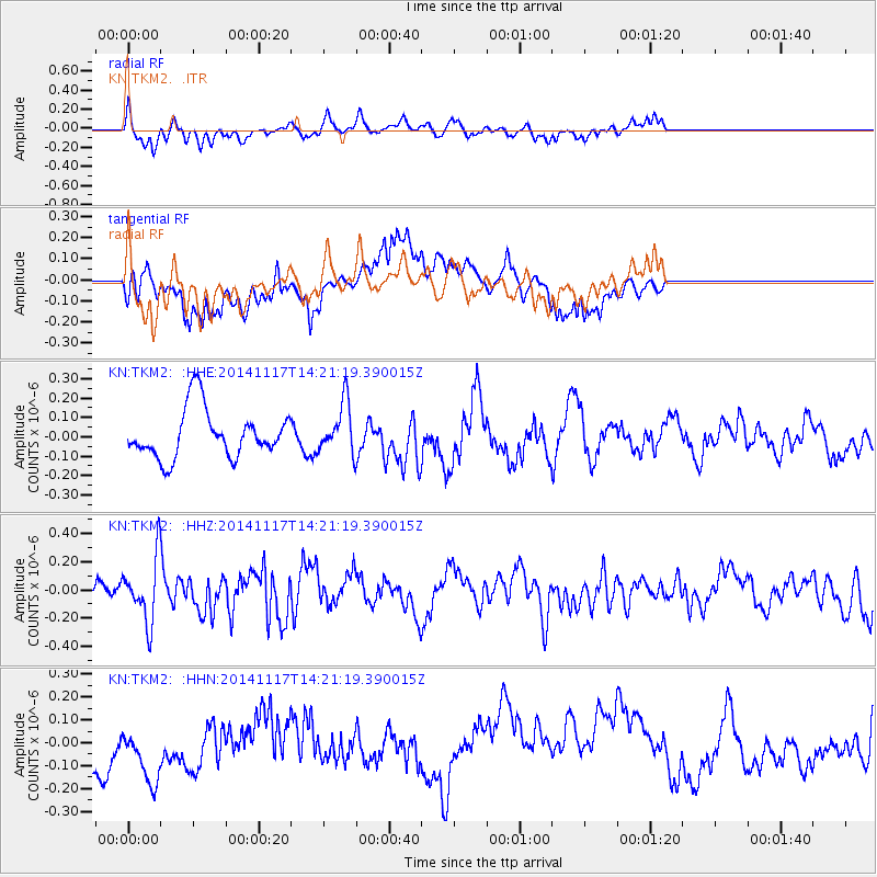
TKM2 - - Earthquake Result Viewer
*The percent match for this event was below the threshold and hence no stack was calculated.
| Earthquake location: |
Philippine Islands Region |
| Earthquake latitude/longitude: |
19.6/120.5 |
| Earthquake time(UTC): |
2014/11/17 (321) 14:13:43 GMT |
| Earthquake Depth: |
23 km |
| Earthquake Magnitude: |
5.2 MW, 5.3 mb, 4.9 MS |
| Earthquake Catalog/Contributor: |
ISC/ISC |
|
| Network: |
KN Kyrgyz Seismic Telemetry Network |
| Station: |
TKM2 - |
| Lat/Lon: |
42.92 N/75.60 E |
| Elevation: |
2020 m |
|
| Distance: |
44.2 deg |
| Az: |
311.988 deg |
| Baz: |
107.428 deg |
| Ray Param: |
$rayparam |
*The percent match for this event was below the threshold and hence was not used in the summary stack. |
|
| Radial Match: |
63.79972 % |
| Radial Bump: |
334 |
| Transverse Match: |
49.422325 % |
| Transverse Bump: |
362 |
| SOD ConfigId: |
3390531 |
| Insert Time: |
2019-04-15 02:00:22.254 +0000 |
| GWidth: |
2.5 |
| Max Bumps: |
400 |
| Tol: |
0.001 |
|
Signal To Noise
| Channel | StoN | STA | LTA |
| KN:TKM2: :HHZ:20141117T14:21:19.390015Z | 2.4529057 | 2.2011153E-7 | 8.973502E-8 |
| KN:TKM2: :HHN:20141117T14:21:19.390015Z | 1.3837498 | 1.8928294E-7 | 1.3678985E-7 |
| KN:TKM2: :HHE:20141117T14:21:19.390015Z | 1.035345 | 1.2923223E-7 | 1.2482047E-7 |
| Arrivals |
| Ps | |
| PpPs | |
| PsPs/PpSs | |


