You are here: Home > Network List > TA - USArray Transportable Network (new EarthScope stations) Stations List
> Station A21K Barrow, AK, USA > Earthquake Result Viewer
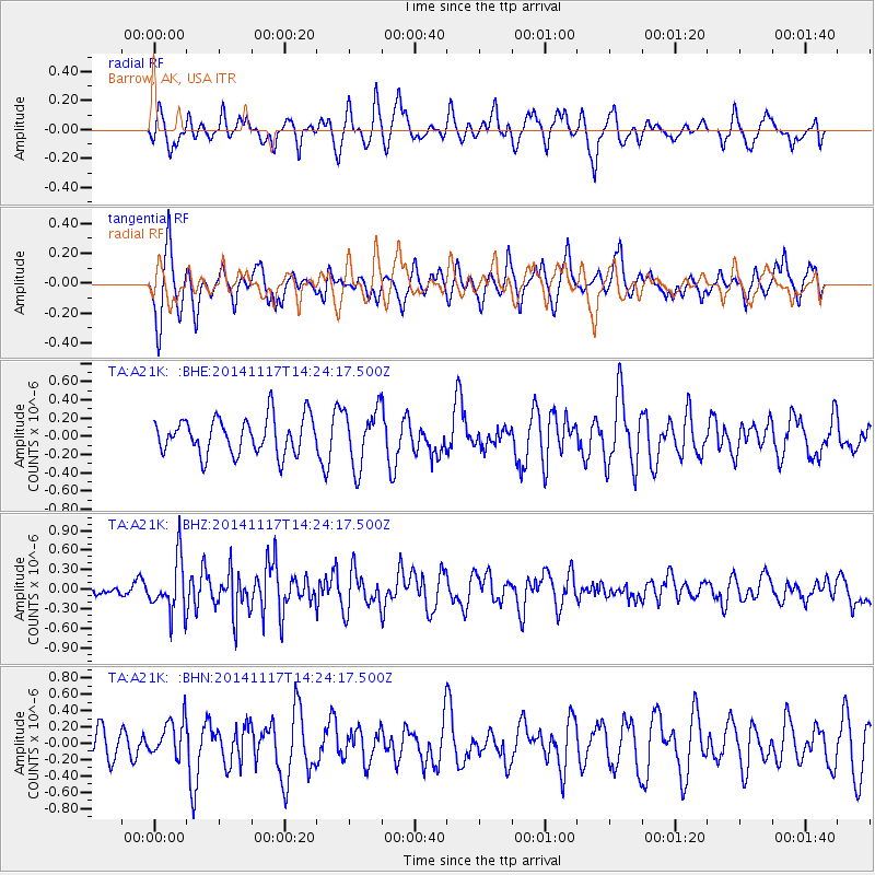
A21K Barrow, AK, USA - Earthquake Result Viewer
*The percent match for this event was below the threshold and hence no stack was calculated.
| Earthquake location: |
Philippine Islands Region |
| Earthquake latitude/longitude: |
19.6/120.5 |
| Earthquake time(UTC): |
2014/11/17 (321) 14:13:43 GMT |
| Earthquake Depth: |
23 km |
| Earthquake Magnitude: |
5.2 MW, 5.3 mb, 4.9 MS |
| Earthquake Catalog/Contributor: |
ISC/ISC |
|
| Network: |
TA USArray Transportable Network (new EarthScope stations) |
| Station: |
A21K Barrow, AK, USA |
| Lat/Lon: |
71.32 N/156.62 W |
| Elevation: |
577 m |
|
| Distance: |
69.3 deg |
| Az: |
19.98 deg |
| Baz: |
269.833 deg |
| Ray Param: |
$rayparam |
*The percent match for this event was below the threshold and hence was not used in the summary stack. |
|
| Radial Match: |
54.080273 % |
| Radial Bump: |
400 |
| Transverse Match: |
66.92039 % |
| Transverse Bump: |
400 |
| SOD ConfigId: |
3390531 |
| Insert Time: |
2019-04-15 02:01:16.818 +0000 |
| GWidth: |
2.5 |
| Max Bumps: |
400 |
| Tol: |
0.001 |
|
Signal To Noise
| Channel | StoN | STA | LTA |
| TA:A21K: :BHZ:20141117T14:24:17.500Z | 2.4067073 | 4.0373712E-7 | 1.6775498E-7 |
| TA:A21K: :BHN:20141117T14:24:17.500Z | 0.9860362 | 2.2662431E-7 | 2.2983366E-7 |
| TA:A21K: :BHE:20141117T14:24:17.500Z | 1.5751255 | 3.1493784E-7 | 1.9994461E-7 |
| Arrivals |
| Ps | |
| PpPs | |
| PsPs/PpSs | |


