You are here: Home > Network List > TA - USArray Transportable Network (new EarthScope stations) Stations List
> Station Q58A Fox Den Farm, The Plains, VA, USA > Earthquake Result Viewer
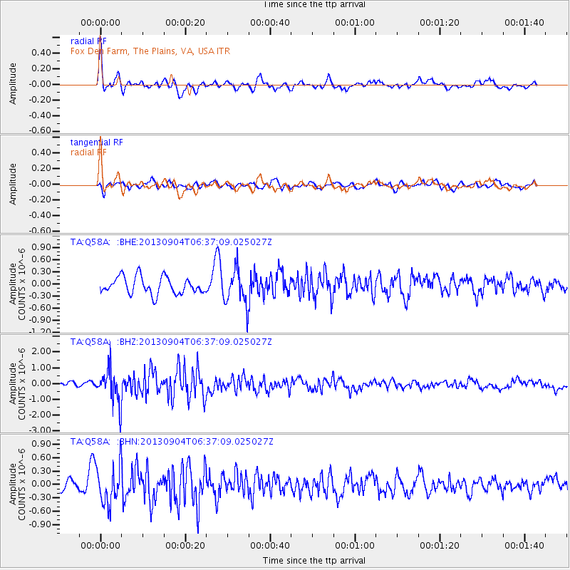
Q58A Fox Den Farm, The Plains, VA, USA - Earthquake Result Viewer
*The percent match for this event was below the threshold and hence no stack was calculated.
| Earthquake location: |
Andreanof Islands, Aleutian Is. |
| Earthquake latitude/longitude: |
51.6/-174.9 |
| Earthquake time(UTC): |
2013/09/04 (247) 06:27:03 GMT |
| Earthquake Depth: |
17 km |
| Earthquake Magnitude: |
6.0 MWW, 5.5 ML, 5.9 MWB, 6.0 MWW, 6.1 MWC, 6.1 MI |
| Earthquake Catalog/Contributor: |
NEIC PDE/NEIC COMCAT |
|
| Network: |
TA USArray Transportable Network (new EarthScope stations) |
| Station: |
Q58A Fox Den Farm, The Plains, VA, USA |
| Lat/Lon: |
38.94 N/77.68 W |
| Elevation: |
182 m |
|
| Distance: |
64.6 deg |
| Az: |
58.902 deg |
| Baz: |
316.745 deg |
| Ray Param: |
$rayparam |
*The percent match for this event was below the threshold and hence was not used in the summary stack. |
|
| Radial Match: |
70.06736 % |
| Radial Bump: |
400 |
| Transverse Match: |
34.698013 % |
| Transverse Bump: |
400 |
| SOD ConfigId: |
626651 |
| Insert Time: |
2014-04-18 12:04:52.803 +0000 |
| GWidth: |
2.5 |
| Max Bumps: |
400 |
| Tol: |
0.001 |
|
Signal To Noise
| Channel | StoN | STA | LTA |
| TA:Q58A: :BHZ:20130904T06:37:09.025027Z | 6.4484105 | 1.0775759E-6 | 1.6710723E-7 |
| TA:Q58A: :BHN:20130904T06:37:09.025027Z | 2.3296657 | 4.2067046E-7 | 1.8057118E-7 |
| TA:Q58A: :BHE:20130904T06:37:09.025027Z | 2.081409 | 4.404118E-7 | 2.1159312E-7 |
| Arrivals |
| Ps | |
| PpPs | |
| PsPs/PpSs | |


