You are here: Home > Network List > TA - USArray Transportable Network (new EarthScope stations) Stations List
> Station R11A Troy Canyon, Currant, NV, USA > Earthquake Result Viewer
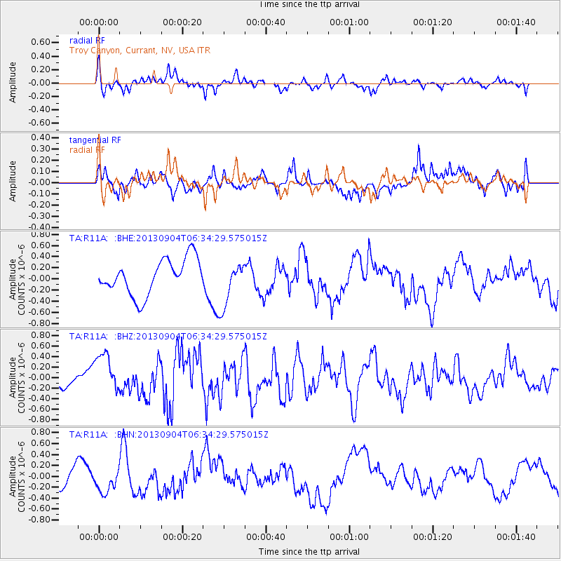
R11A Troy Canyon, Currant, NV, USA - Earthquake Result Viewer
*The percent match for this event was below the threshold and hence no stack was calculated.
| Earthquake location: |
Andreanof Islands, Aleutian Is. |
| Earthquake latitude/longitude: |
51.6/-174.9 |
| Earthquake time(UTC): |
2013/09/04 (247) 06:27:03 GMT |
| Earthquake Depth: |
17 km |
| Earthquake Magnitude: |
6.0 MWW, 5.5 ML, 5.9 MWB, 6.0 MWW, 6.1 MWC, 6.1 MI |
| Earthquake Catalog/Contributor: |
NEIC PDE/NEIC COMCAT |
|
| Network: |
TA USArray Transportable Network (new EarthScope stations) |
| Station: |
R11A Troy Canyon, Currant, NV, USA |
| Lat/Lon: |
38.35 N/115.59 W |
| Elevation: |
1756 m |
|
| Distance: |
42.8 deg |
| Az: |
83.948 deg |
| Baz: |
307.88 deg |
| Ray Param: |
$rayparam |
*The percent match for this event was below the threshold and hence was not used in the summary stack. |
|
| Radial Match: |
55.2493 % |
| Radial Bump: |
374 |
| Transverse Match: |
55.301865 % |
| Transverse Bump: |
384 |
| SOD ConfigId: |
626651 |
| Insert Time: |
2014-04-18 12:05:04.008 +0000 |
| GWidth: |
2.5 |
| Max Bumps: |
400 |
| Tol: |
0.001 |
|
Signal To Noise
| Channel | StoN | STA | LTA |
| TA:R11A: :BHZ:20130904T06:34:29.575015Z | 2.1100035 | 3.8615892E-7 | 1.830134E-7 |
| TA:R11A: :BHN:20130904T06:34:29.575015Z | 0.77248895 | 2.1203728E-7 | 2.7448584E-7 |
| TA:R11A: :BHE:20130904T06:34:29.575015Z | 1.2422982 | 3.9092345E-7 | 3.146776E-7 |
| Arrivals |
| Ps | |
| PpPs | |
| PsPs/PpSs | |


