You are here: Home > Network List > TA - USArray Transportable Network (new EarthScope stations) Stations List
> Station R56A Bull Pasture Mountain, McDowell, VA, USA > Earthquake Result Viewer
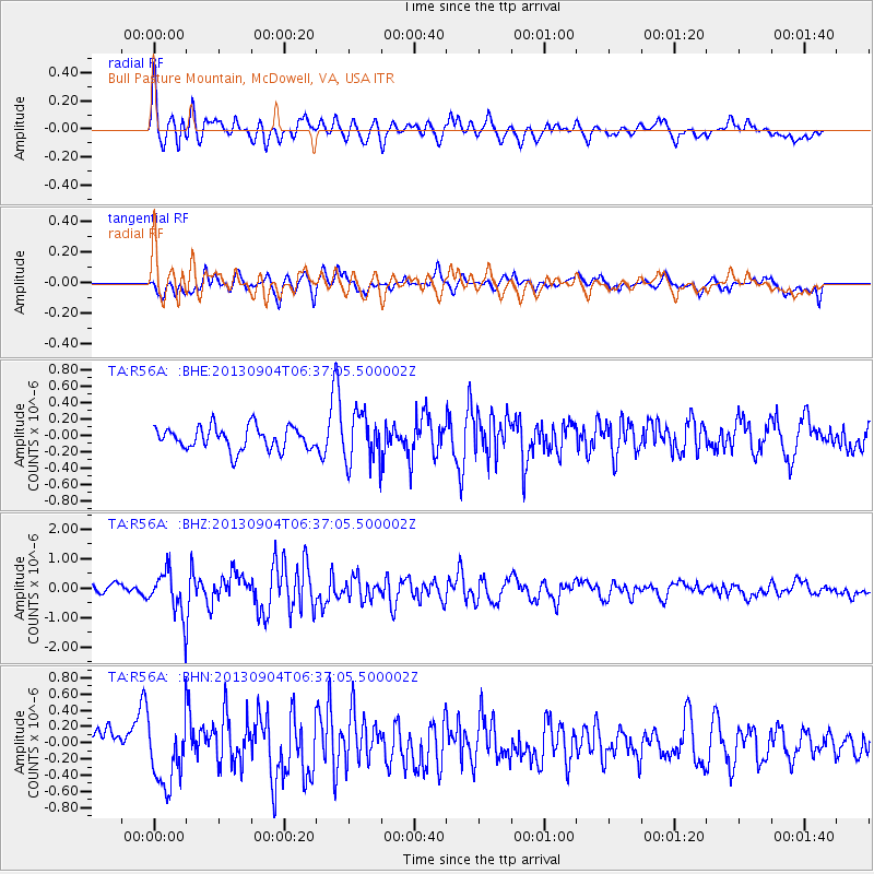
R56A Bull Pasture Mountain, McDowell, VA, USA - Earthquake Result Viewer
*The percent match for this event was below the threshold and hence no stack was calculated.
| Earthquake location: |
Andreanof Islands, Aleutian Is. |
| Earthquake latitude/longitude: |
51.6/-174.9 |
| Earthquake time(UTC): |
2013/09/04 (247) 06:27:03 GMT |
| Earthquake Depth: |
17 km |
| Earthquake Magnitude: |
6.0 MWW, 5.5 ML, 5.9 MWB, 6.0 MWW, 6.1 MWC, 6.1 MI |
| Earthquake Catalog/Contributor: |
NEIC PDE/NEIC COMCAT |
|
| Network: |
TA USArray Transportable Network (new EarthScope stations) |
| Station: |
R56A Bull Pasture Mountain, McDowell, VA, USA |
| Lat/Lon: |
38.41 N/79.40 W |
| Elevation: |
902 m |
|
| Distance: |
64.1 deg |
| Az: |
60.393 deg |
| Baz: |
316.319 deg |
| Ray Param: |
$rayparam |
*The percent match for this event was below the threshold and hence was not used in the summary stack. |
|
| Radial Match: |
60.544247 % |
| Radial Bump: |
400 |
| Transverse Match: |
38.8928 % |
| Transverse Bump: |
400 |
| SOD ConfigId: |
626651 |
| Insert Time: |
2014-04-18 12:05:21.881 +0000 |
| GWidth: |
2.5 |
| Max Bumps: |
400 |
| Tol: |
0.001 |
|
Signal To Noise
| Channel | StoN | STA | LTA |
| TA:R56A: :BHZ:20130904T06:37:05.500002Z | 4.2399063 | 7.355979E-7 | 1.7349389E-7 |
| TA:R56A: :BHN:20130904T06:37:05.500002Z | 1.9286045 | 4.082713E-7 | 2.1169258E-7 |
| TA:R56A: :BHE:20130904T06:37:05.500002Z | 2.1229258 | 2.9544213E-7 | 1.3916743E-7 |
| Arrivals |
| Ps | |
| PpPs | |
| PsPs/PpSs | |


