You are here: Home > Network List > AZ - ANZA Regional Network Stations List
> Station SMER AZ.SMER > Earthquake Result Viewer
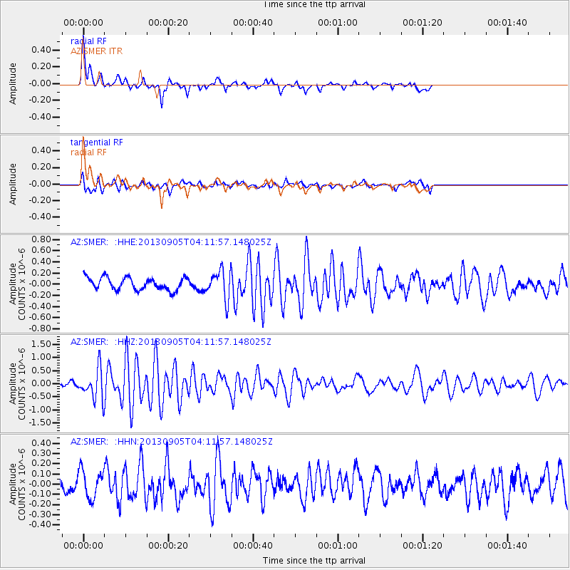
SMER AZ.SMER - Earthquake Result Viewer
*The percent match for this event was below the threshold and hence no stack was calculated.
| Earthquake location: |
Northern Mid-Atlantic Ridge |
| Earthquake latitude/longitude: |
15.2/-45.2 |
| Earthquake time(UTC): |
2013/09/05 (248) 04:01:36 GMT |
| Earthquake Depth: |
10 km |
| Earthquake Magnitude: |
6.0 MWW, 5.9 MWB, 6.0 MWW, 6.0 MWC |
| Earthquake Catalog/Contributor: |
NEIC PDE/NEIC COMCAT |
|
| Network: |
AZ ANZA Regional Network |
| Station: |
SMER AZ.SMER |
| Lat/Lon: |
33.46 N/117.17 W |
| Elevation: |
355 m |
|
| Distance: |
66.9 deg |
| Az: |
300.189 deg |
| Baz: |
86.675 deg |
| Ray Param: |
$rayparam |
*The percent match for this event was below the threshold and hence was not used in the summary stack. |
|
| Radial Match: |
79.555984 % |
| Radial Bump: |
309 |
| Transverse Match: |
62.82098 % |
| Transverse Bump: |
400 |
| SOD ConfigId: |
626651 |
| Insert Time: |
2014-04-18 12:21:06.817 +0000 |
| GWidth: |
2.5 |
| Max Bumps: |
400 |
| Tol: |
0.001 |
|
Signal To Noise
| Channel | StoN | STA | LTA |
| AZ:SMER: :HHZ:20130905T04:11:57.148025Z | 5.758587 | 5.7904083E-7 | 1.005526E-7 |
| AZ:SMER: :HHN:20130905T04:11:57.148025Z | 1.8496194 | 1.3848836E-7 | 7.4873974E-8 |
| AZ:SMER: :HHE:20130905T04:11:57.148025Z | 2.378574 | 2.634083E-7 | 1.1074213E-7 |
| Arrivals |
| Ps | |
| PpPs | |
| PsPs/PpSs | |


