WRPS We R Penn State - Earthquake Result Viewer
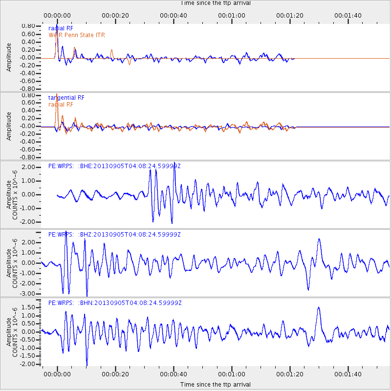
Earthquake location: Northern Mid-Atlantic Ridge
Earthquake latitude/longitude: 15.2/-45.2
Earthquake time(UTC): 2013/09/05 (248) 04:01:36 GMT
Earthquake Depth: 10 km
Earthquake Magnitude: 6.0 MWW, 5.9 MWB, 6.0 MWW, 6.0 MWC
Earthquake Catalog/Contributor: NEIC PDE/NEIC COMCAT
Network: PE Penn State Network
Station: WRPS We R Penn State
Lat/Lon: 40.79 N/77.87 W
Elevation: 320 m
Distance: 38.1 deg
Az: 318.451 deg
Baz: 122.49 deg
Ray Param: 0.075746335
Estimated Moho Depth: 15.5 km
Estimated Crust Vp/Vs: 1.62
Assumed Crust Vp: 6.121 km/s
Estimated Crust Vs: 3.784 km/s
Estimated Crust Poisson's Ratio: 0.19
Radial Match: 84.86968 %
Radial Bump: 234
Transverse Match: 70.39356 %
Transverse Bump: 400
SOD ConfigId: 626651
Insert Time: 2014-04-18 12:36:20.373 +0000
GWidth: 2.5
Max Bumps: 400
Tol: 0.001

Signal To Noise

ChannelStoNSTALTA
PE:WRPS: :BHZ:20130905T04:08:24.59999Z10.985031.5712259E-61.4303336E-7
PE:WRPS: :BHN:20130905T04:08:24.59999Z5.2460636.644546E-71.2665775E-7
PE:WRPS: :BHE:20130905T04:08:24.59999Z5.065021.0004386E-61.9751919E-7
Arrivals
Ps1.7 SECOND
PpPs6.2 SECOND
PsPs/PpSs7.8 SECOND